 |
| This
map is the original concept of the Isle of Standauffish based on our geographical
layout at the "Age
of Chivalry" Renaissance Faire in Las vegas, Nevada. We were layed
out in a rectangle, the Rogue's Cove to the northwest near the lake (for
their cannon firings), the Port of Shalott with the Merchant booths to
the northeast. In the southwest we had the two Celtic Clans, which were
in the hilly tree area. The southeast corner was taken by the City of Mediterannius,
an Italian Renaissance group with Roman ruins and horses, so they got the
flat fields. Our Monastery took the traditional position, south of the
Merchants.
When we drew our Historical Maps, we kept the Isle roughly rectangular, gave the Pirates a craggy cove and smuglars cave, The Port needed a safe Harbour, the Clans had their trees, and as one Clan came from California we put them off on a little island of their own. Mediteranius had the rolling hills and fields, and their Roman ruins became a watch tower left over from the Roman invasion of Wales and England. The Monastery wanted some mountains or at least cliffs to get away from it all. Thus the Isle came into being. |
 |
| This
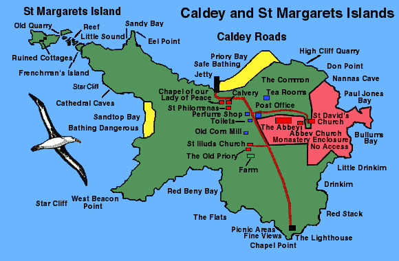
map is the actual Caldey Island as it is today. The smuglars caves, Cathedral
Caves, are almost where we had ours. The Rogue's Cove a little furthur
south, has a beach with dangerous rocks. The forested area and the fertile
fields are reversed, but still there. There are two stone quarries on the
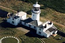
island. The Roman watch tower? Well, that spot has a modern lighthouse
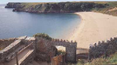
built on the ruins of an old beacon! The Celtic Clans you ask? Well there are still ruins of Cottages on the little sister Isle of St Margarets! No mountains, but the cliffs in the south are there, though the current Monastery is further to the north, but then this one was built in 1906. Below is a picture of an old wall from a Monastery from 1116. Oh, and who according to History owned the Isle in 1500? Seems that from 1506 to about 1650, there is no record of anyone on the Island. Can one say these coincidents are uncanny? Yes, true enough, but the real scary one deals with our own Abbot and the Black Monk of Caldey Island 1506, a popular ghost story on the island today. |
   |
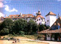
| Caldey Island Lighthouse Caldey Island Caldey Abbey |

Ruins of the old monastery dating back to the 1100"s |
 |
| This map is the final product of all the research and the co-incidents. It is the working model for our guild. The current island has a village of 50 people with a very large Monastery and lots of feilds, forests and open space despite its small size. It is plenty big enough for our own purposes and one day soon we hope to take a field trip and take our Guild to its "home" |

Webpage © 1995-2017 Isle of Standauffish