|
|
||||||||||
|
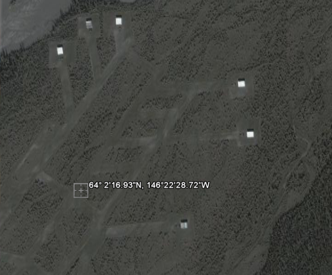
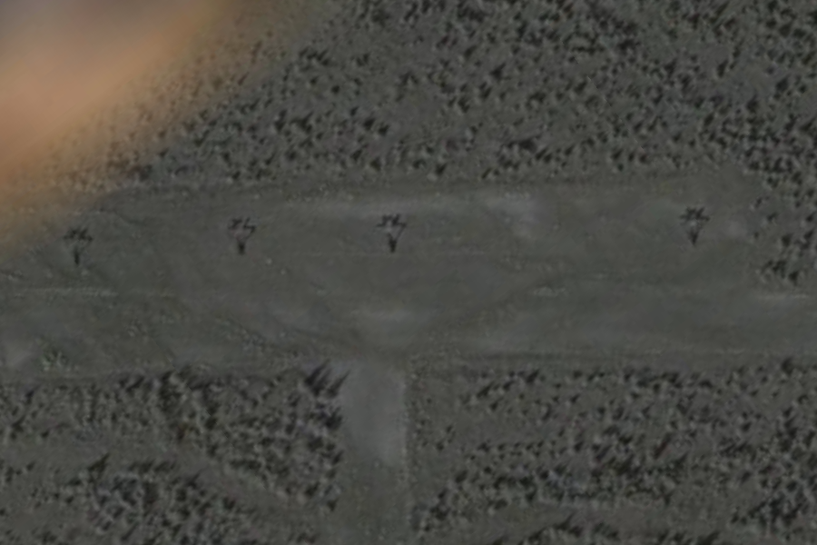
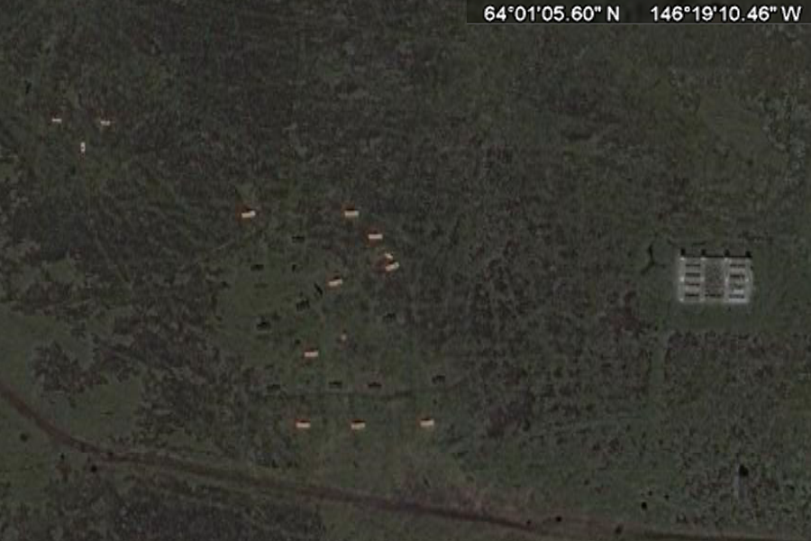
20 miles NNW of Fort Greely 64° 2'16.93"N, 146°22'28.72"W .. Posted by BlasteR, on August 25, 2009 at 03:05 GMT Hi all! Just to kick things off, I've spent alot of time reading and looking into this very bizarre landing strip I found in google earth. After looking around in google earth I discovered this really odd looking (and pretty danged long) landing strip in the middle of nowhere. Landing strip is approximately 1.7 miles (around 2 miles) in length. The coordinates for this location are: 64° 2'16.93"N
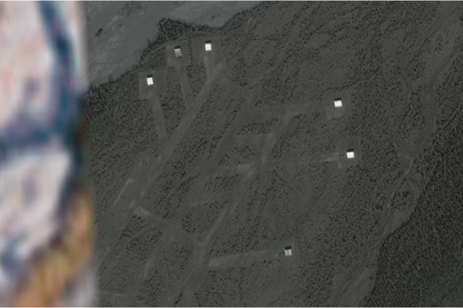
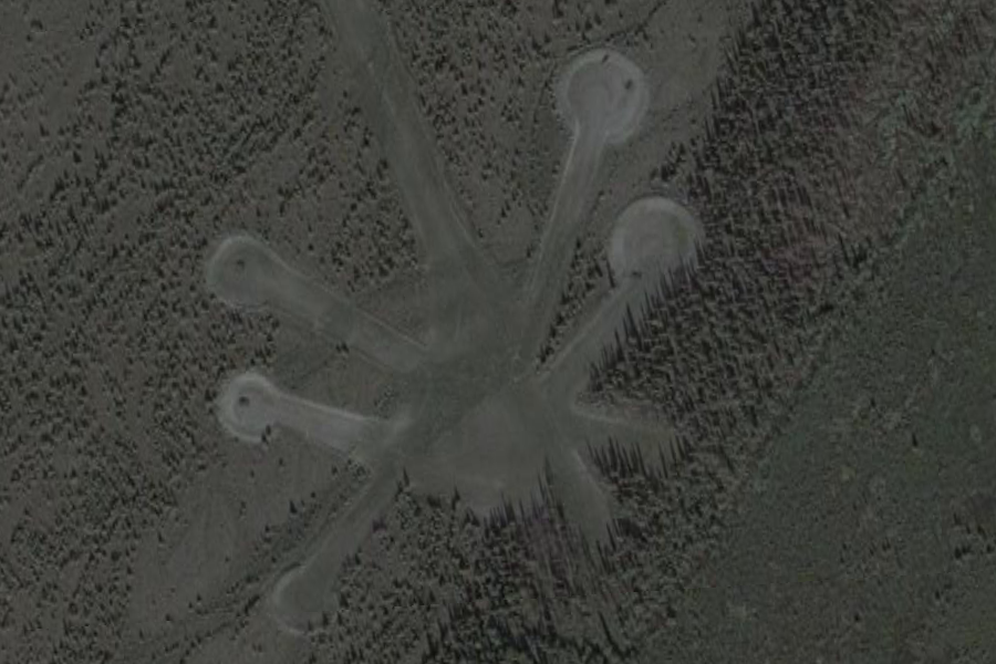
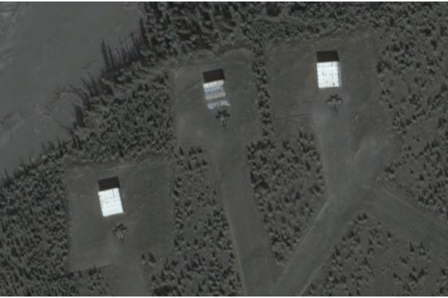
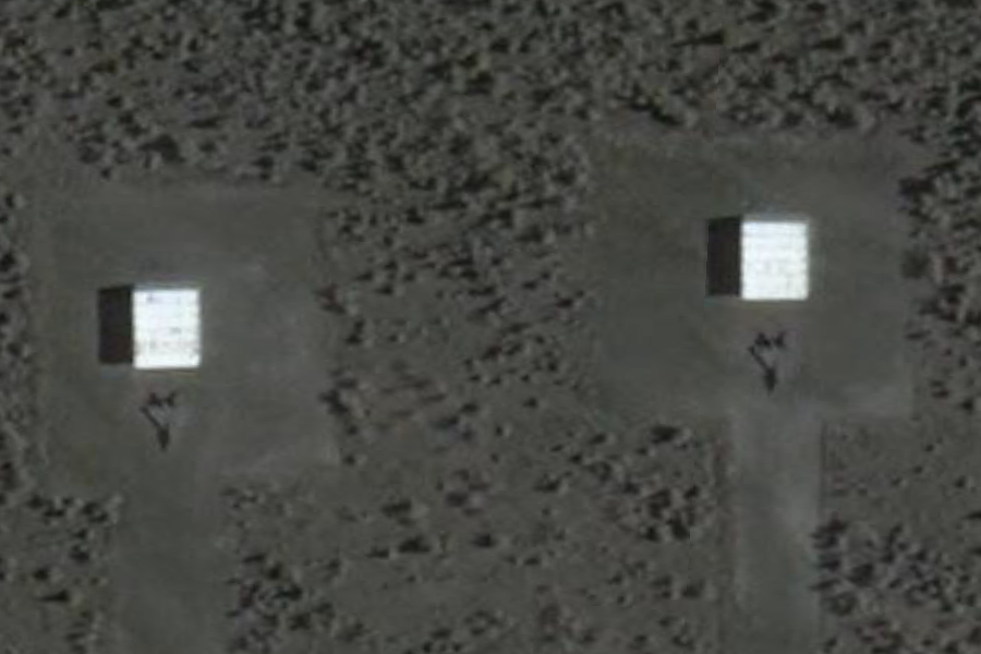
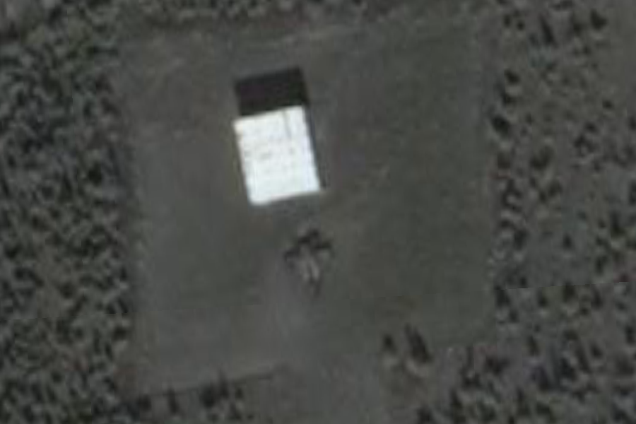
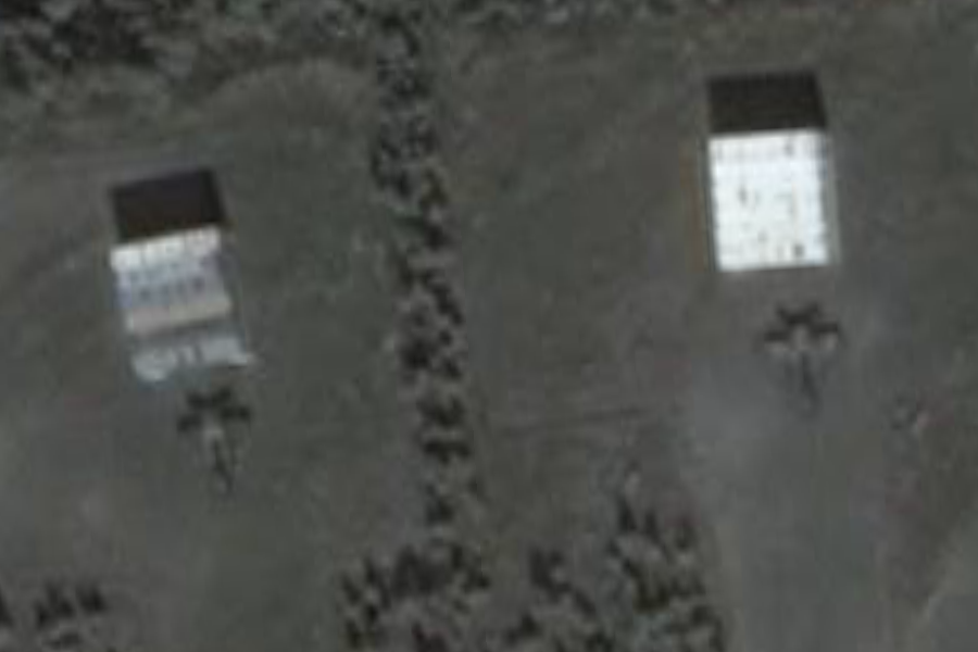
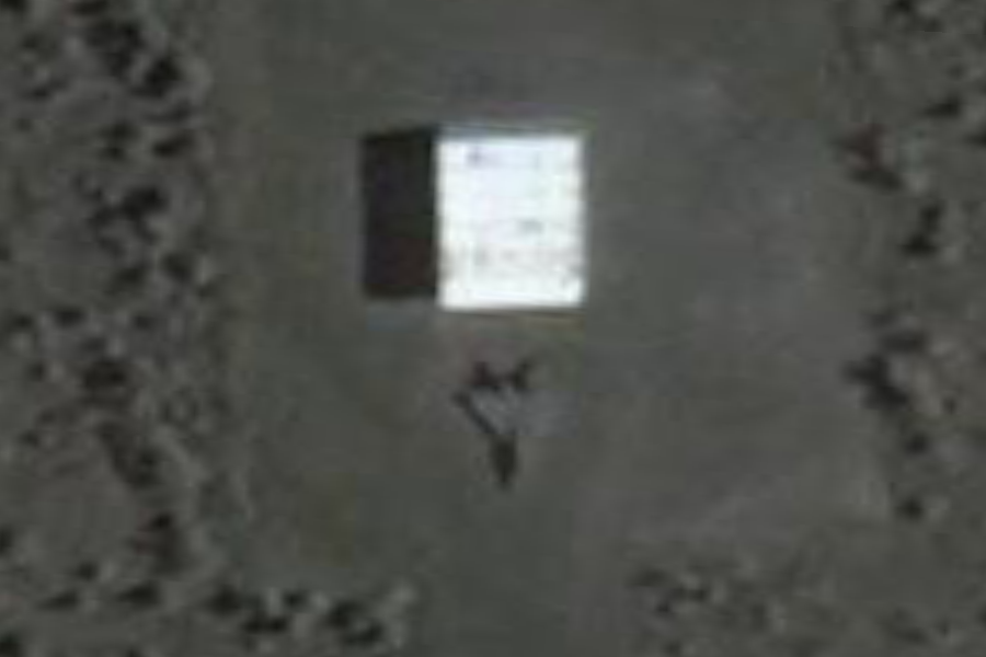
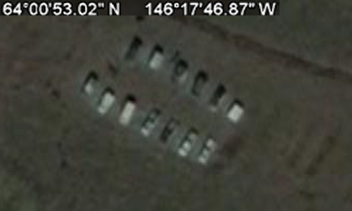
Because of the details of my job, I am not at liberty to discuss the particulars of my work and although not all of it is classified I do work in an area of the private sector where information is highly confidential. But keep in mind that everything I will post here is publicly available on the internet and is unclassified material (just to get things straight right off the bat). Alot of it is difficult to find, however. Just for some personal background, I spent 6 years in the USAF working in the 2w0x1 career field in munitions systems (non-nuclear). The work I did was really wide-ranging. Everything from hauling munitions trailers to and from the flightline to building conventional bombs and processing 30mm ammunition for the A-10's. Because of my work in the military, I saw about every aircraft in the inventory either coming or going at some point, everything from A-10's to B-2's and U-2 spy planes. The runway in question at the above coordinates has a variety of aspects that point to this being a classified operating location. The area is completely remote and is about 20 miles from Fort Greely (army post) which lies to the SE from the location of the runway. West of Fort Greely (across the Richardson Highway) lies what we call the "Donnelly Training Area" named after the nearby "Donnelly Dome" which is a very distinct land feature in this area. Donnelly Training Area is a pretty immense tract of land. Some of it is public land because of the Pipeline running through it and the pumping stations along the pipeline. But most of it is government-owned land used for a wide variety of training purposes. Fort Greely is home to the new Missile Defense site and CRTC (Cold Regions Test Center). The area of the remote runway does not lie in the inclusive area of the Donnelly Training Area, rather, it seems it is a completely separate operating location from Greely or Donnelly Training area. The odd thing is, there are no support facilities.. There is a 1.7 mile pair of runways and taxiways on the Northeast end of the runway. The runway isn't even gravel or dirt. It appears to be akin to freshly-mowed grass. The white squares you see behind some of the aircraft originally looked to me like some kind of temporary structures for housing the aircraft. After looking at the image a little closer, I believe these are for deflection of aircraft thrust up and away from the treeline. There appears to be a built-in system designed for quick-reaction takeoffs. Also notice the complex system of strips, taxiways, and aircraft parking (all apparently built around the idea of launching aircraft at a moment's notice). For Reconnaissance?? Here is a list of the Alaskan military facilities and their distance from this remote airstrip: Eielson AFB...........50 miles away
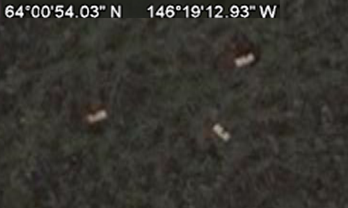
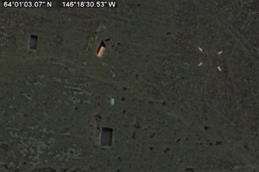
The nearest site is, of coarse, Fort Greely which is an army base anyway (no fighters to speak of). The Donnelly Training Area West/SW from Fort Greely is used for Army training purposes. Yet there is a remote airstrip with odd looking fighter jets 20 miles from civilization in the middle of the boonies with no support facilities to speak of and a grass airstrip. Could there be facilities underground to hide them from satellites? This is not your standard military airstrip. This looks to have been built and constructed for a very specific purpose. Also notice that some of the planes are missing (possibly even flying sorties at the time the google earth images were shot?). There is a reason this facility was built and there is also a reason they are using this particular airstrip for these jets instead of the various other facilities throughout the state. Here are some images...
..
..
..
deflector in the middle. This and the shadows tell me that's what these are ..
..
..
..
..
.. |
||||||||||
| Originally posted by airforcephotographer,
a member of ATS
Post ID 6974240
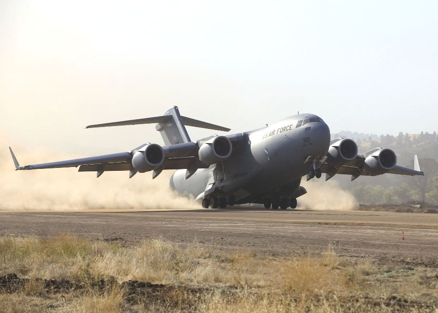
Reply to post by BlasteR Sir, This is all a good theory. But I am an Air Force photographer stationed at Elmendorf Air Force Base. I flew to the above-mentioned location in a C-12 yesterday to take pictures of the C-17's stationed here doing dirt-landings and assisting in an Army Pre-Deployment Training Exercise. All the airstrip is used for is practicing dirt landings. Nothing special about it really. The remote location is only to keep the complaints down from locals on the noise, dust disturbance etc. that this causes with each landing. Also it is close to a sister Army base and gives us a good location in assisting with their many exercises in which they are not equipped to practice air-exercise. Please let me know if you have any other questions on this particular landing strip. Thanks! SrA Laura ----- |
||||||||||
|
Posted
by BlasteR, on August 25, 2009 at 03:05 GMT
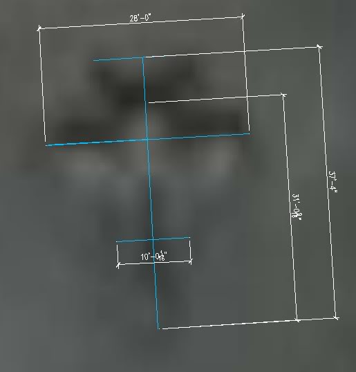
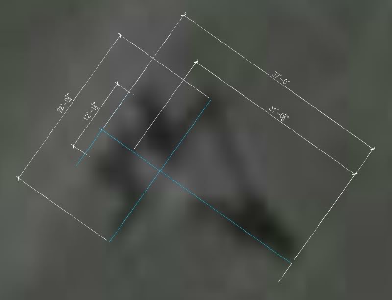
In order to get an accurate assessment of the actual dimensions of these jets, I measured the wingspan of one of the jets in google earth. I then exported the image to Autocad and scaled 2 of the aircraft closeups to full-scale. I then added dimensions in Autocad to show the measurements. Here's what we're dealing with... ...
..
Keep in mind this is an estimated size of this particular kind of aircraft. This is not 100% accurate but probably in the ballpark. Wingspan.......................................................
28 feet
This appears to be a delta-wing type configuration
with 2 powerplants.
Any thoughts or opinions on what this could be? Right off the bat, I'd like to thank Zorgon's for his assistance with this and for posting content up on his website regarding this bizarre landing strip in the middle of the Alaskan wilderness. -ChriS |
||||||||||
| Originally posted by zorgon
Here in Nevada we have a Red Flag site north of Nellis AFB and LAS Vegas. Maybe this is the Red Flag area of Eielson AFB RED FLAG - ALASKA Eielson Air Force Base and Elmendorf Air Force Base are the home of RED FLAG-Alaska, a realistic, 10-day air combat training exercise held up to four times a year. Each RED FLAG-Alaska exercise is a multi-service, multi-platform coordinated, combat operations exercise and corresponds to the designed operational capability of participating units. In other words, exercises often involve several units whose military mission may differ significantly from that of other participating units. RED FLAG-Alaska planners take those factors into consideration when designing exercises so participants get the maximum training possible without being placed at an unfair advantage during simulated combat scenarios.http://www.eielson.af.mil/library/factsheets/factsheet.asp?id=5545 What struck me most was the lack of facilities on the site save for the hangers. Very similar to Nellis' area RED FLAG-Alaska is a Pacific Air Forces-sponsored exercise. Originally named COPE THUNDER, it was moved to Eielson Air Force Base, Alaska, from Clark Air Base, Philippines, in 1992 after the eruption of Mount Pinatubo on June 15, 1991 forced the curtailment of operations. COPE THUNDER was redesignated RED FLAG-Alaska in 2006.http://en.wikipedia.org/wiki/Red_Flag_-_Alaska C-17s in Alaska Ramp Up to Go Operational ELMENDORF AIR FORCE BASE, Alaska, Aug. 21, 2007 – Long-range, heavy airlift resources for wartime and humanitarian efforts across the globe will be a day’s flying time closer to the need in less than a month.http://www.defenselink.mil/news/newsarticle.aspx?id=47129 Well that gives us the dirt landing strip.. But it still doesn't explain THESE ..
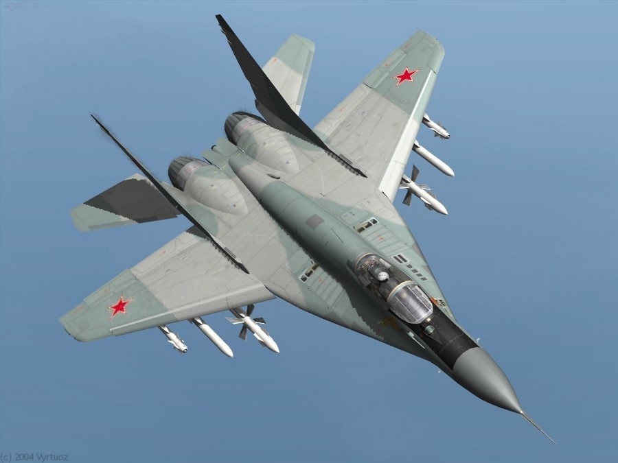
So where is out airforce photographer... I have questions Laura Originally posted by zorgon Here is something... tied into the Red Flag operation.. You mentioned MIG's, I have been captivated by these Russian planes for many years and have had the opportunity to cover MIG-29's that participated in [color=Yellow]Red Flag at Nellis Air Base[/color] and also did an in-flight profile on a MIG-17, totally fascinating. [color=Yellow]They all take off and land from dirt runways[/color], are suitable for extreme weather, etc. None of our planes are as capable in those areas. I think we have much to learn, hopefully the new Joint Strike Fighter will change things, and if I'm not mistaken, the Marines will get the aircraft too, that is good, they always get the least.[/ex]http://www.salem-news.com/articles/november042007/f-15_crash_11407.php ..
. |
||||||||||
|
Dirt Runway Testing for C17's ..
Dirt runway testing increases
C-17 safety, agility
11/24/2006 - EDWARDS AIR FORCE BASE, Calif. (AFPN) -- In an effort to expand the capability of the C-17 Globemaster III, about 40 people from the C-17 Integrated Test Force are in the midst of a four-phase test program to determine the C-17 takeoff and landing performance on non-paved surfaces. Engineers and pilots are testing the aircraft in extreme runway conditions to eventually write the book for landing on dirt runways during dry, wet, and muddy runway conditions. Phase 2 is scheduled to get under way here Dec. 4. It follows lessons learned from flight tests conducted during Phase 1, which occurred between Sept. 16 and Nov. 8 at Fort Hunter Liggett, Calif. According to Lt. Col. Bob Poremski, C-17 Integrated Test Force director, the first phase put the C-17 through tests to validate the ability to bring a large force into an airfield without making runway condition corrections. Testing at Fort Hunter Liggett started with a dry landing zone "without re-grooming or re-preparing the runway to see if it's able to sustain rapid deployment operations with enough aircraft," Colonel Poremski said. "Once that was done, we progressively wet the ground in a controlled manner to correlate how much rainfall would happen if something like a thunderstorm rolls by and drops a quarter-inch of rain to see the effect it has on the braking action of the aircraft." The purpose of the testing is to open up the capability to bring warfighters and equipment closer to the combat zone so there is not as much transit time. "The C-17 was designed to deliver forces and cargo from an initial pick-up point and directly to the battlefield. This is called the direct-delivery concept," Colonel Poremski said. "But the original testing only cleared a small portion of the types of surface the earth is made out of. Our testing is expanding the types of surfaces the C-17 can operate in and out safely." Performing tests on wet, semi-prepared runways proved to be a challenge, said Gus Christou, a mechanical subsystems engineer with Edwards' 418th Flight Test Squadron. "The biggest concern we had was executing this test on a relatively short runway," Mr. Christou said. "Most of the runways, with the exception of the Edwards runway, are 5,800-feet long. For the wet-testing we proposed in the test plan, we really didn't have enough room to execute on a fully-wetted runway. So, we split the runway into a partial wet section and a partial dry section to ensure the aircraft could perform stopping as well as takeoff (again)." There also was a computer modeling issue. Mr. Christou said the performance software that currently is available for the aircraft addresses both take offs and landings on wet and dry conditions for ordinary concrete runways. However, in this particular case there is a mixed condition runway. "The software cannot predict performance of the airplane on a combination of dry and wet runways," he said. "That existing software had to be blended to accommodate a dry and wet runway. It was very time-consuming." In the end of the testing at Fort Hunter Liggett, the upgraded software models were able to accurately predict the aircraft performance. "But it's quite a spectacular site to see this huge cloud of dust chasing you when you're taking off, and then the same thing happening when you're landing -- a dust cloud chasing you as you come to a stop," Mr. Christou said. The dust clouds and wet dirt that arose from takeoffs and landings added some unusual aspects to the testing process. "Through semi-prepared runway operations testing and weighing the aircraft after the take-offs and landings, we've seen anywhere from 1,200 to 1,500 additional pounds of dirt collected in the aircraft," Colonel Poremski said. "We've seen enough dirt collect in the wheel wells to where it was eight to 10 inches in depth. "However, those sorts of operations are not going to be typical with the aircraft in the field, because they might operate into a field and depart again," he said. "We've been up there with the dirt being wet, and we've repeated the landings multiple times throughout the day, thus helping to force the dirt up into the wheels." There also is the maintenance aspect of the aircraft when dealing with so much collected dirt, said 2nd Lt. Mike Mohr, C-17 semi-prepared runway operations, or SPRO, project manager. "Well after we got into the mud, these guys had to fire hose (the aircraft) down to get the mud off," Lieutenant Mohr said. "Some of the instrumentation on the (landing gear) were kind of epoxied on, and we were having some calibration issues. There were all kinds of things pretty much all throughout the C-17 test the maintenance folks were dealing with, from the nose to the tail." The third and fourth phases are scheduled to take place at Fort Chaffee, Ark., and Fort McCoy, Wis., next year. Officials say all four phases of testing is scheduled to be completed by November 2007. |
||||||||||
| Originally posted by BlasteR,
ATS
Post ID 6976758
reply to post by zorgon While I was in the Air Force I was involved with a couple of the "Cope Thunder" exercises at Eielson. It involved aircraft from multiple different countries and U.S. service branches. To my knowledge, Red Flag used to be held at Nellis, however. Since I've worked there, Eielson has been re-structured. The 355th fighter Squadron no longer flies sorties that I know of. They used to have a squadron of A-10's that flew daily training sorties along with the 18th Fighter Squadron of F-16's. The A-10 hangars probably sit empty for right now, probably being used for other purposes. I also think the 18th Figher Sqaudron has drastically decreased its number of aircraft and daily sorties (though the F-16's are still there). A few years ago, Eielson was slated to be closed altogether. But because of public outcry and support of the local communities the decision was reached to keep the base open. It was a good decision. Eielson has one of the longest runways in the world. It is one of the alternate landing sites for the space shuttle and its infrastructure is immaculate compared to other nearby military facilities (though that is changing as more and more for a variety of reasons). The only catch was.. The mission changed along with the decision to keep it open. It is mostly used for training purposes now because of the vast, unheard-of size of the military airspace surrounding the base. These days, Eielson hosts its own "Red Flag" exercises. I'm not even sure if Cope Thunder is still being held there, but it would make sense. But there is one aspect of Eielson that is not ideal from a standpoint of testing military aircraft. It isn't so remote. However, that doesn't mean the airspace can't still be used. Any aircraft taking off or landing from Eielson can be seen by a family passing by the highway in an RV. Occasionally, during large exercises, there used to be a line of cars and RV's half a mile long to check out the parked aircraft and watch the jets take off. The base is even more exposed now since they've completely de-vegatated the trees and shrubs along the highway on the Southern boundary of the base (the highway being parallel to the runway). They did this because of the bird problem they were having and still have. Fort Greely is extremly remote in comparison. And when you combine that with the fact that they built this airstrip just outside the Western edge of the Donnelly Training Area, the military can ensure the remoteness of the site. Other than trudging through military land to get to the site, the only other access point would be across the river (and they would see you coming anyway). Besides, the military uses technology these days for security that boggles the mind. They even have disguised equipment that can literally hear and smell you coming (and that was 10 years ago). -ChriS |
||||||||||
| Originally posted by BlasteR,
ATS
Post ID 6976890
Originally posted by firepilot
Exactly.. The dimensions of the aircraft aren't even close to being the size of an F-15 anyway. F-15's from Elmendorf land and take off from Eielson all the time. The military wouldn't operate F-15's from such a remote location anyway while they have the manpower and infrastructure in place to support just that kind of mission at Elmendorf and, occasionally, Eielson. They don't have to keep the aircraft secret either. Everyone knows about it. The F-15's already have a permanent facility they operate from in Elmendorf AFB. Besides, The dimensions of an F-15 are completely different than the dimensions of these aircraft.. F-15 Dimensions:
F-35 Dimensions:
F-22 Dimensions:
Dimensions of the aircraft at this remote landing strip
(give or take about a foot):
These jets aren't close to being the F-15, F-22, or even the F-35 given the dimensions. And apart from the dimensions, these couldn't be F-15's anyway because of the geometry of the back end in particular. F-15's have vertical stabilizers that are near vertical (if not perfectly). The aircraft parked along this landing strip DO have 2 vertical stabilizers but they are canted at an upwards angle much like the F-35's. Except the F-35 is over 13 feet longer than these aircraft. Red Flag training exercises being hosted by Eielson (as they now are) involve military aircraft temporarily stationed AT EIELSON. There is a reason for that. Let's say the Navy wants to fly F-18's for a specific Red Flag exercise being hosted by Eielson AFB. They're going to send all their support hardware, all their maintenance personnel, all their tools, etc... TO EIELSON for the specific purpose of flying sorties out of that location. They're not going to fly their jets to a remote airstrip in the middle of nowhere where they can't maintain their aircraft, While at the same time taking the risk of damage to their aircraft by flying sorties to and from a remote location with a landing strip made up of grass and dirt. And while you can't completely eliminate the possibility that such a facility might be used occasionally for training purposes in particular, it doesn't make a whole lot of sense to spend this kind of money to build an elaborate, remote landing strip while we already have the facilities and infrastructure to host the Red Flag exercises.. NO, this looks to me like this particular facility was constructed for a very specific mission involving a very specific type of aircraft. They didn't want to gain attention to this mission and thats why they needed a remote location to operate from. These aircraft never have to land at any other military facility if they don't absolutely have to and this was the perfect location to operate such a facility from and support such a secretive mission. This is a remote airstrip built and designed for a very specific purpose that doesn't necessarily involve training missions of any kind. Other bases and facilities in the area are designed for hosting training exercises. This one is definately not. I'm still at a loss for what these aircraft really are. The dimensions don't match up even close to anything I've seen yet. And that makes them much more interesting. -ChriS |
||||||||||
| Originally posted by BlasteR,
ATS
Post ID 6977005
reply to post by RoofMonkey Precisely!
When you really get down to brass tax here and look at the numbers, none of the dimensions or characteristics of any known aircraft in the inventory match up with what we're seeing here in the google earth satellite photos. At least nothing I've seen yet. Not to say these couldn't be some kind of new, experimental UAV.. Or something else.. Think about it though. Geopolitically, the far east is slowly destabilizing over time. Granted, some American facilities in South Korea already have spy planes and reconnaissance aircraft of their own. But what a perfect location to launch recon sorties from with a new, state of the art aircraft. Noone ever has to see them coming or going. In fact, noone even has to know they were even there. With the right technology, you could fly aircraft right over China or any other country without any country having to ever see you. And with technology like pulse detonation, you could have an aircraft there in no time if Lil kim starts threatening a nuke strike or if Russia decides to send a few Bear bombers our way with the idea of giving us a really bad day. Even a U-2 landing at a base in South Korea can be seen by the entire base (and city/towns surrounding the base). With such a remote landing site, noone ever has to see these jets. The aircraft can fly quick-reaction sorties if they need to and the very existence and technology of the planes can be kept entirely secret (at least until they're caught on google earth). It's almost like they've been prepositioned just in case. They could also have a nuclear and/or missile defense related mission (but of coarse we have no way of knowing that for sure). But think about the precise location of the airstrip with relation to the missile defense site at Fort Greely and the airstrip's location with relation to Fairbanks, AK and Anchorage, AK.. Prime ground for a missile-defense related mission too. Lots of possibilities here and they're all open for speculation. But what is still more interesting to me than what the mission might be are the dimensions of these jets. Very different. I'm definately no self-proclaimed expert in military aircraft but this is appears to be a very special, very unique kind of airplane. It's fascinating stuff. -ChriS |
||||||||||
|
Other Interesting Stuff ....
Old Bombing Target, barely visible now ..
These look like rocket launchers ..
LOTS of Tanks ..
Tanks and Structure Originally posted by vita eternus, a member of ATS Post ID 6971600 You're actually NOT seeing the entire runway complex. What is being displayed is the northern section of the runway that was constructed AFTER July 19, 2005. The southern section of the runway is NOT being shown as that section of the Google map display is prior to construction i.e. PRE July 19, 2005. This means that there may also be supporting buildings/complexes around the southern part of the runway which would not be visible if constructed AFTER July 19, 2005. Also, there is some kind of storage area located approx
6kms east of the runway at location
which has a direct road connection to the runway. Plus many other associated structures /objects scattered
around at location
..
....
..
..
|
||||||||||
| Originally posted by RoofMonkey
ATS
Post ID 6995993
Reply to post by ajsr71 USARAK - 5 YEAR RANGE PLAN - [PDF][Archived] Nice snag. From your reference, and overlaid on Goog Maps, that puts the Craft site in a "Dudded Impact Area". ...
... |
||||||||||
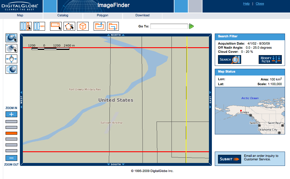
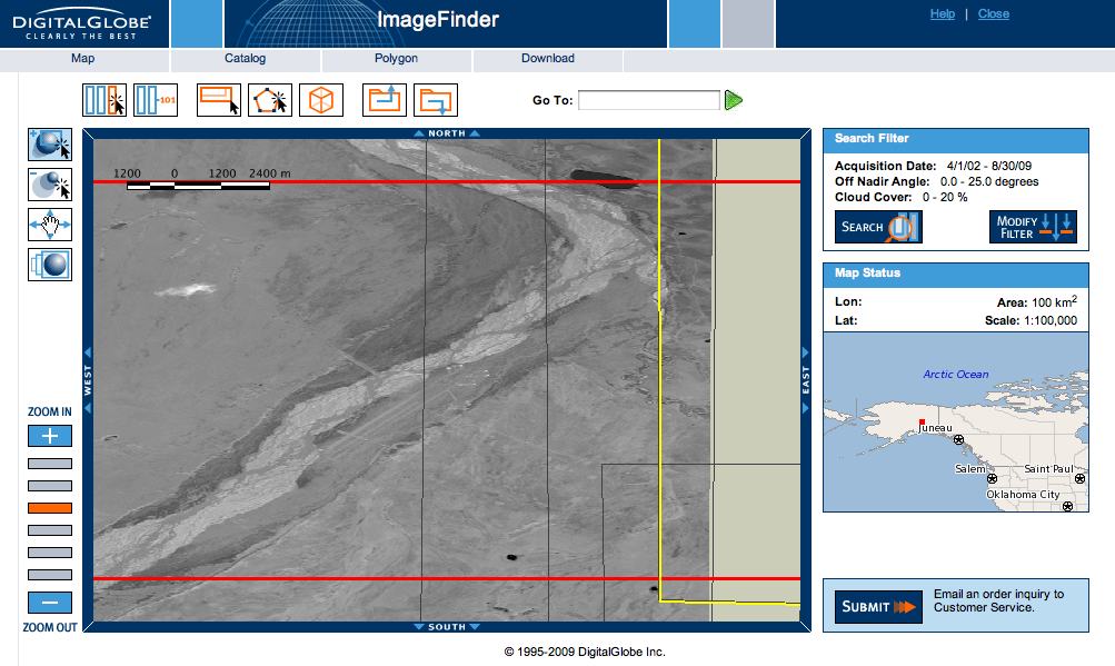
| Originally posted by Stoo ATS
Post ID 6996306
Digitalglobe has the original coords down as "Sullivan Airstrip" ? Catalog ID: 1020010007E21D00
...
... |
||||||||||
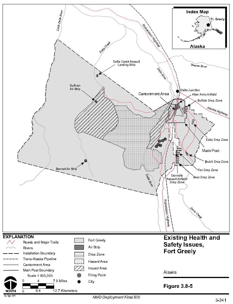
| Originally posted by ajsr71
ATS
Post ID 6998383
Well we now have a name for the Airstrip. So a search brought up this H&S document for Fort Greely. Section 3.8.1.4 page 3.241 has a map of the area showing the location of Sullivan Airstrip and other LS/ DZ's FORT GREELY H&S ISSUES - [PDF][Archived] ...
... |
||||||||||
| Originally posted by RoofMonkey
ATS
Post ID 6998645
Well, now we know where the name came from. Same doc, ch 3a
|
||||||||||
| Related Links:
|
||||||||||
| FAIR USE NOTICE: This page contains copyrighted material the use of which has not been specifically authorized by the copyright owner. Pegasus Research Consortium distributes this material without profit to those who have expressed a prior interest in receiving the included information for research and educational purposes. We believe this constitutes a fair use of any such copyrighted material as provided for in 17 U.S.C § 107. If you wish to use copyrighted material from this site for purposes of your own that go beyond fair use, you must obtain permission from the copyright owner. | ||||||||||
|
|
