|
Nevada |
|||||
|
Area 12 ..
The Nevada Test Site (NTS) is located in Nye County in southern Nevada about 75 miles northwest of Las Vegas. The site is about 1,350 square miles. After World War II, the United States began testing its nuclear weapons in the Pacific Ocean, more specifically in the Bikini Atoll, a chain of island in the South Pacific. In 1950, President Truman called for an acceleration in the development of nuclear weapons. To support this effort, the government needed a location where testing could take place that would not require the extensive logistic efforts and inordinate amounts of time traveling to remote areas of the Pacific. The area in Nevada was chosen because it met certain criteria such as low population density, favorable year round weather conditions, and reasonable access. Despite the harsh climate, the area around the Nevada Test Site was home to a large array of plants and animals. The site is a transitional zone between the Great Basin and the Mojave Desert. Species from both deserts, including those native to one but not the other, are found in the area.
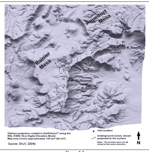
Nuclear Tests From 1951 until 1992, there were 928 nuclear tests conducted at the Nevada Test Site. Many of the tests that occurred used plutonium and other materials produced at Hanford. The nuclear tests carried out at the NTS can be divided into two main eras. The first is the atmospheric testing that took place from January 1951 through October 1958. The second was the underground testing that took place from 1961 until 1992. Although there were a few surface, near surface, and crater tests conducted from 1961 to 1968, the vast majority of nuclear weapons tests have been carried out underground since 1961. Of the 928 tests, only 100 of those were atmospheric and the other 828 were conducted underground. Most of the underground tests were conducted under the Yucca Flat, but there were a few tests that took place under Buckboard, Pahute, and Rainer Mesas. All testing at the site stopped when the United States entered into a moratorium on nuclear weapons testing in October of 1992. The atmospheric tests were visible to the residents of Las Vegas, whose population was less than 50,000 at the time. The Atomic Energy Commission distributed an information guide to the residents near the testing ground. Beginning with the line "You are in a very real sense active participants in the Nation's atomic test program." It went on to explain what was happening on the site and attempted to reassure the safety of the tests. The program claimed that any radioactive clouds created from the tests "does not constitute a serious hazard to any living thing outside the test site." SOURCE: Nevada Test Site - Washington Nuclear Museum and Education Center |
|||||
|
|||||
|
Miners Camp ..
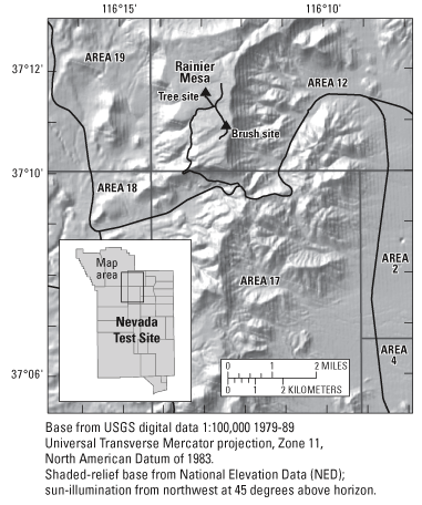
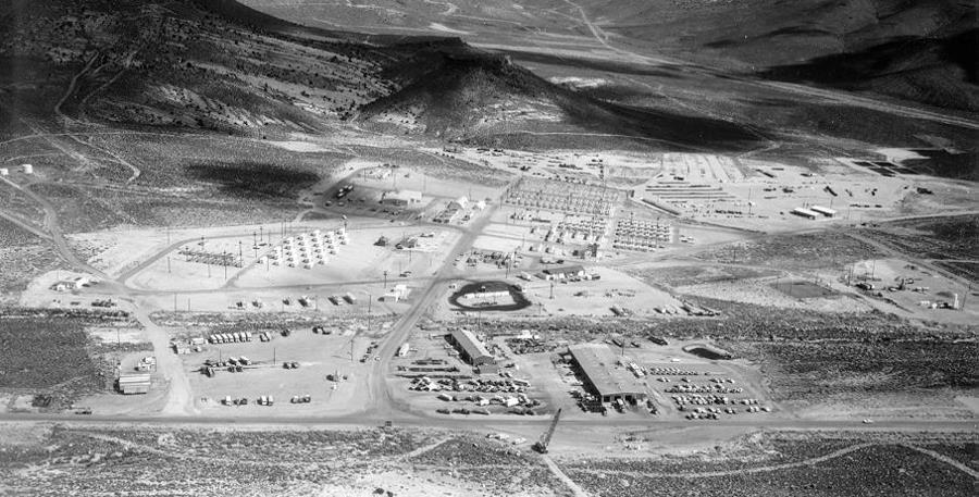
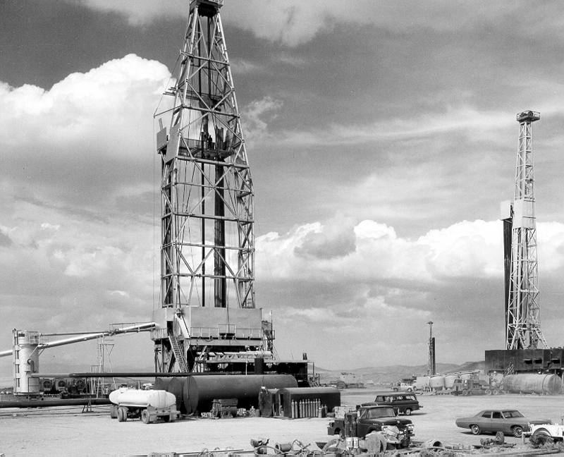
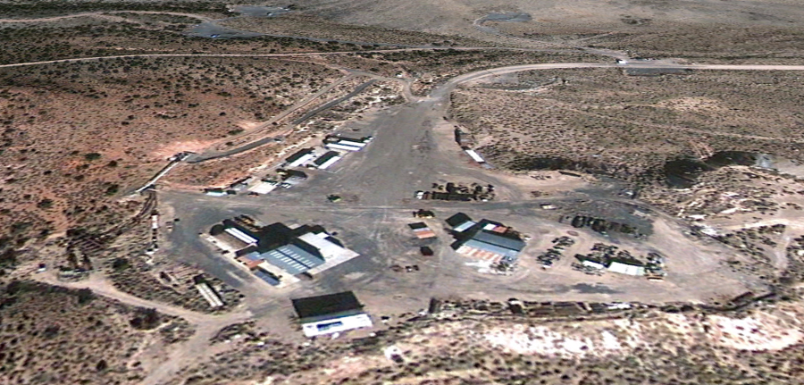
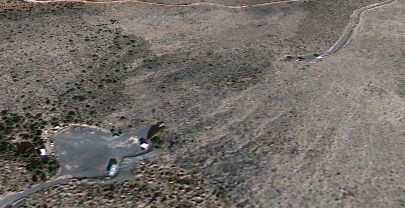
Photo Number: WB212 The Area 12 Camp, located at the extreme Northwest end of the Nevada Test Site, supports miners from the tunnels in Ranier Mesa with overnight accomodations for 600 people. Nevada Test Site - BACHUS
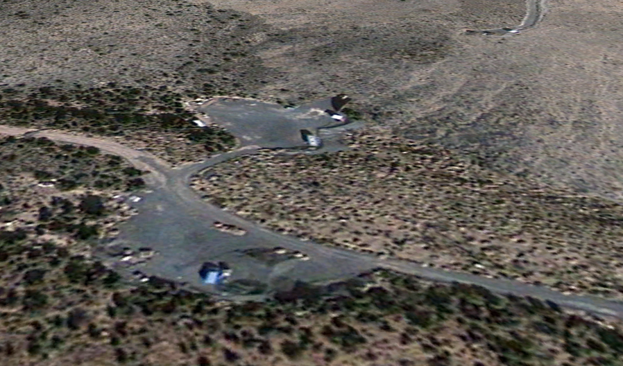
In 1997, the Defense Threat Reduction Agency (DTRA) began a secret program to simulate a Rogue Nation's or terrorist group's clandestine biological weapons program, according to the New York Times and ABC News. The program, code-named BACHUS (Biotechnology Activity Characterization by Uncoventional Signatures), used low-cost, commercially available off-the shelf technology to produce a small quantity of benign simulant with properties similar to Anthrax. The site chosen by DTRA was a small abandoned building in a closed part of the Nevada Test Site, because of the security afforded by being located within the perimeter of the NTS. Moreover, the building (Building 12-7) was a former recreation center and barber shop and was small, low-signature building. BACHUS was to provide a small, real-world target to test various ground-based, airborne, and space based Measurement and Signature Intelligence (MASINT) sensors and determine whether these sensors would be able to aquire a clandestine BW weapons lab. MASINT: The counter-proliferation intelligence Discipline. Measurement and Signature Intelligence (MASINT) is scientific and technical intelligence information obtained by quantitative and qualitative analysis of data (metric, angle, spatial, wavelength, time dependence, modulation, plasma, and hydromagnetic); all of which are derived from specific technical sensors for the purpose of identifying any distinctive features associated with the source, emitter, or sender and to facilitate subsequent identification and/or measurement of the same. Laser imaging systems can be used to detect and classify chemical/biological agents emitted in the production process. Multi-spectral and hyperspectral imagery systems can be employed as well. Imagery Analysis Using video ground truth imagery from an ABC News report, coupled with Microsoft's Terraserver imagery of the Nevada Test Site taken in 1998, as well as other publically available information, we were able to identify the building in which the simulated weapons lab was located. Building 12-7 Building 12-7 is a mustard-colored building with interior dimensions measuring 120 feet long and 40 feet wide. It is located near a number of other buildings of roughly the same size. A note on signatures Signatures are indicators that make a target identifiable or cause it to stand out. Key signature properties are uniqueness and stability. Uncommon or unique features reduce the ambiguity of an indicator and minimize the number of other indicators that must be observed to confirm a single indicator's significance. Conventional indicators of a biological weapons program might include the existence of biological research facilities operated under military control, the large-scale production of vaccines in excess of legitimate domestic needs, or the purchase of dual-use biological materials and equipment. A noticeable signature for such a program is crucial to the intelligence community's ability to monitor the proliferation activities of states and terrorist groups. DTRA's BACHUS project seems predicated on the possibility that a terrorist group or rogue nation might try to develop a clandestine minimal BW program completely apart from legitimate commercial pharmacutical R&D efforts that would be more visible and susceptible to standard Western intelligence efforts. Such a program could be funded on a shoe-string budget and would only require a few hundred square feet of floor space. It is reported that BACHUS was able to gather the necessary materials including a 50-liter fermenter and sample biological agents producing only non-harmful bio-pesticides during two trial runs in 1999 and 2000, for roughly $1 million and completely through the open market. Whether DTRA was able to successfully test MASINT sensors and whether those sensors were successful in detecting and characterizing the facility at Building 12-7, a clandestine BW capability, are not known to the public. The key question is what degree of cross-sensor cueing and multidisciplinary cueing is required for detection. Disclosure appears to be timed to Congressional Budget The public revelation of the existence of such a highly classified program seems to be timed to Congressional appropriation hearings for funding of DTRA Biological Weapons programs. BACHUS was initiated without the knowledge of senior Clinton White House officials, but had the approval of DoD and CIA officials. SOURCE: Nevada Test Site - BACHUS - Global Security |
|||||
Related Links:
History of the Nevada Test Site and Nuclear Testing Background - National Cancer Institute - [PDF][Archived] Radiation Exposure Compensation Act: Program Status - United States Government Accountability Office - [PDF][Archived] |
|||||
..
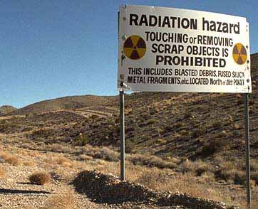
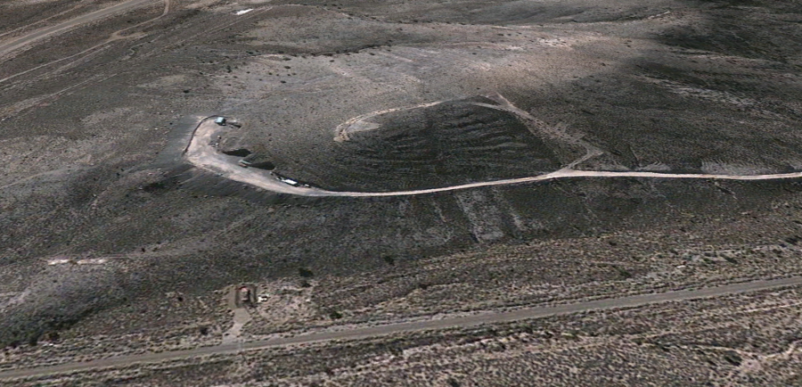
Photo courtesy of National Nuclear Security Administration / Nevada Site Office Test Site contamination The atmospheric tests left heavy fallout. Some areas of the Nevada Site are still so radioactive that anyone entering must wear hazmat suits. The underground tests would vaporize a large chamber which left a radioactive cavity. The tests conducted near or on the surface resulted in the creation of large craters. These explosions deposited radioactive material into the ground and sometimes directly into aquifers. The DOE estimates that more than 300 million curies of radiation has been deposited in the ground of the test site. This makes the Nevada Test Site the most radioactively contaminated place in the nation. The fallout from these atmospheric tests released approximately 150 million curies of iodine-131. The main peaks of contamination occurred in 1953, 1955, and 1957. A third of the underground tests were conducted in aquifers, while others were hundreds or thousand feet above the water table. Federal scientists claim that the contamination above the aquifers should remain suspended in the perpetually dry soil, although critics argue there is no evidence to prove this. In the "hottest" zones, radioactivity in the water reaches millions of picocuries per liter. Although radiation levels in the water have declined, the longer-living isotopes will continue to pose risks for tens of thousands of years. Many of the test bombs were part of the Plowshare program, which began in 1958. The goal of the program was to develop peaceful uses for nuclear explosives. Over a span of fifteen years the AEC conducted thirty five Plowshare tests. The excavation tests were designed to demonstrate that nuclear devices could quickly and cheaply move massive amounts of earth that could be useful in digging of canals and harbors. The largest of these tests was the Sedan Test. Buried 635 feet below ground level, the 104-kiliton blast lifted a large dome of earth 290 feet in the air and moved 6.5 million cubic yards of earth and rock. The crater that was left behind was 1,200 feet across and 320 feet deep. The lip of the crater towered as high as 100 feet into the air. This explosion also caused a radioactive cloud to move toward Salt Lake City. The inability to contain the radioactivity and disappointing results eventually caused the program to be canceled in the mid 1970s. SOURCE: Nevada Test Site - Washington Nuclear Museum and Education Center |
|||||
Nevada Test Site Tours - Department of Energy - Las Vegas, Nv ..
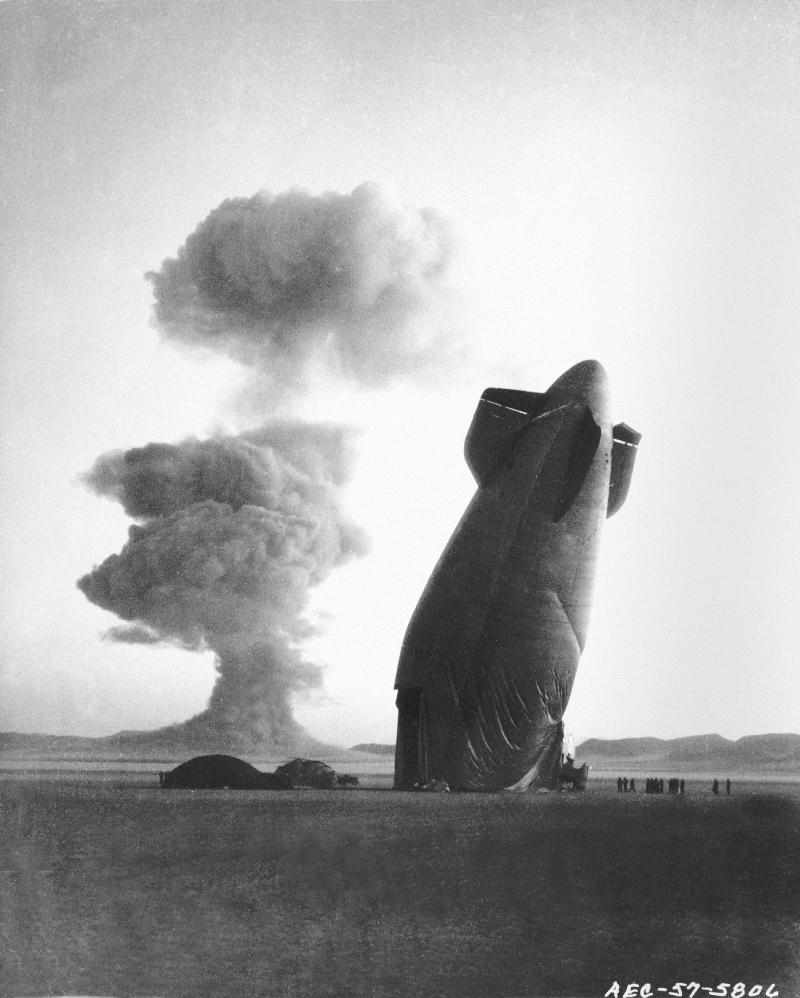
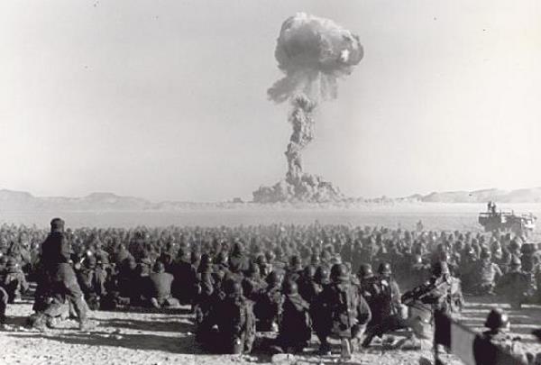
The atomic device dropped from an airplane detonates at a height of 1,417 feet, with the power of 21,000 tons of TNT. Fall 1951 Continental Test Series (Buster-Jangle} Approximate distance 7 miles. Photo - Defense Special Weapons Agency - SOURCE |
|||||
|
The Nevada National Security Site[1] (N2S2), previously the Nevada Test Site (NTS), is a United States Department of Energy reservation located in southeastern Nye County, Nevada, about 65 mi (105 km) northwest of the city of Las Vegas. Formerly known as the Nevada Proving Grounds,[2] the site, established on 11 January 1951, for the testing of nuclear devices, is composed of approximately 1,360 sq mi (3,500 km2) of desert and mountainous terrain. Nuclear testing at the Nevada Test Site began with a 1-kilotonne-of-TNT (4.2 TJ) bomb dropped on Frenchman Flat on 27 January 1951. Many of the iconic images of the nuclear era come from NTS. The Nevada Test Site contains 28 areas, 1,100 buildings, 400 miles (640 km) of paved roads, 300 miles (480 km) of unpaved roads, ten heliports and two airstrips. SOURCE - Wikipedia |
|||||
|
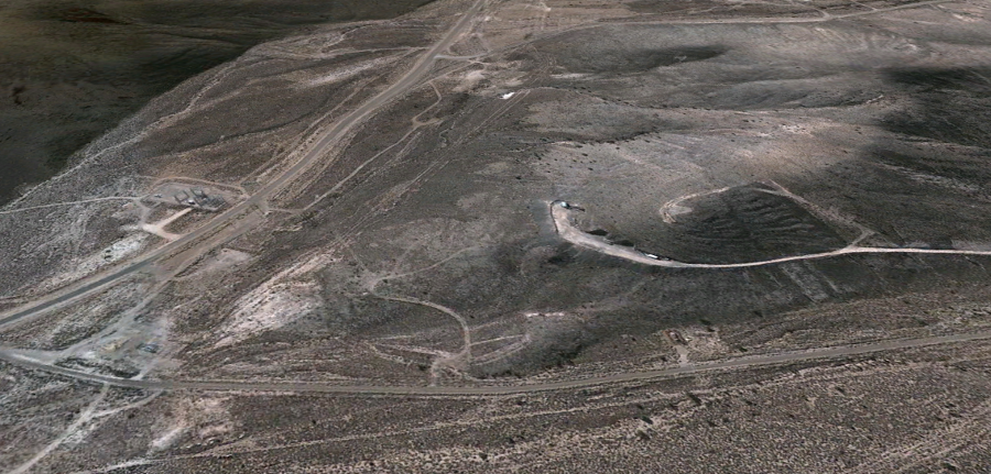
37°11'28.64" N 116°10'24.49" W ..
|
|||||
|
37°10'21.70" N 116°11'40.97" W ..
..
|
|||||
| FAIR USE NOTICE: This page contains copyrighted material the use of which has not been specifically authorized by the copyright owner. Pegasus Research Consortium distributes this material without profit to those who have expressed a prior interest in receiving the included information for research and educational purposes. We believe this constitutes a fair use of any such copyrighted material as provided for in 17 U.S.C § 107. If you wish to use copyrighted material from this site for purposes of your own that go beyond fair use, you must obtain permission from the copyright owner. | |||||
|
|
