|
Australia's Area 51 |
|||||
|
|||||
|
Near Alice Springs, NWT, Australia ..
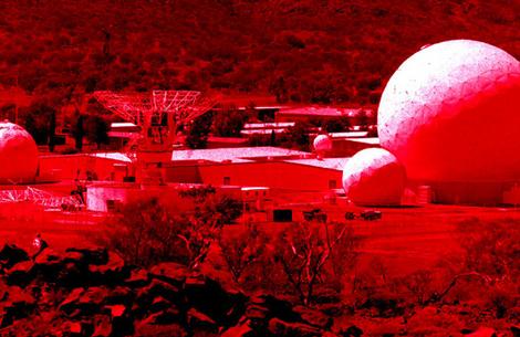
Pine Gap, near Alice Springs, employs nearly 1,000 people, mainly from the Central Intelligence Agency and the National Reconnaissance Office. Originally code-named MERINO, it is the ground station for a satellite network that intercepts telephone, radio, data links, and other communications around the world. The facility currently includes a dozen radomes, a 5,600 square meter computer room, and 20-odd service and support buildings. Two of its ground antenna are part of the U.S. Defense Satellite Communications System. In 1988 a new 10-year lease for the US facilities was signed by then Prime Minister Bob Hawke. The agreement specified a three-year notification period which required the Australian government to give notice in 1995 to close both Nurrungar and Pine Gap in 1998, when the leases come up for renewal. Australia arranged to have greater access to the information collected by the bases. When Nurrungar closes in 2000, some Nurrungar hardware and personnel will be moved to Pine Gap. Sources and Methods:
|
|||||
Pine Gap is the commonly used name for a satellite tracking station at 23.799o S, 133.737o E, south-west of the town of Alice Springs in the heart of Australia that is operated by Australia and the U.S. It consists of a large computer complex with eight radomes protecting antennas, and has over 800 employees. It is officially called the Joint Defence Facility Pine Gap. It is believed to be one of the largest ECHELON ground stations and appears to be physically and operationally similar to the signals intelligence facilities at Buckley Air Force Base, Colorado and Menwith Hill, United Kingdom. U.S. government personnel at Pine Gap are believed to be mostly from the National Security Agency and subordinate service-associated agencies, and the Central Intelligence Agency. While much of its operation is secret, Pine Gap is known to be involved in numerous military satellite operations. As a result, it is occasionally targeted for protests, most recently during the war in Afghanistan. In 1999, with the Australian Government refusing to give details to an Australian Senate committee on treaties, Intelligence expert Professor Des Ball from the Australian National University was called to give an outline of Pine Gap. According to Professor Ball, since 9 December 1966 when the Australian and U.S. governments signed the Pine Gap treaty, Pine Gap has grown from the original two antennas to about a dozen and a half in 1999. The number of staff has also increased, from around 400 in the early 1970s, to 600 in the early 1990s, and then to an expected 1,000 early this century. The biggest expansion occurred after the end of the Cold War. He described the CIA-run facility as the ground control and processing station for geosynchronous satellites engaged in signals intelligence collection, outlining four categories of signals collected:
Each morning the Joint Reconnaissance Schedule Committee meets to determine what the satellites will monitor over the next 24 hours. With the closing of the Nurrungar base in 1999, an area in Pine Gap was set aside for the U.S. Air Force's control station for infrared satellites that monitor heat emissions from missiles, giving first warning of ballistic missile launches. |
|||||
|
Pine Gap at Night Protestors Breach Security ..
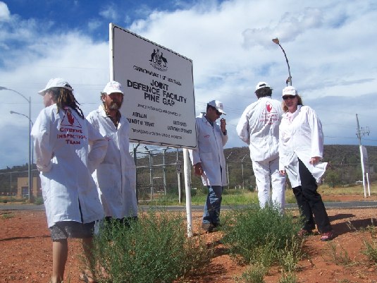
December, 2005 Just as Gary McKinnon was given a harsh sentence for hacking into government computers, so too are these four protestors being dealt with in an Australian Court... Excerpt Webdiarist Bryan Law faces jail on Pine Gap protest These words, placed by Webdiarist Bryan Law on Webdiary in 2005, paint the best picture: Merry Christmas from Pine GapLate at night on Thursday the 8th, four of us, Donna Mulhearn and Brian Law in one group and Jessica Goldie and myself in the other started the walk to the base from two different directions. We walked for five hours and three hours respectively. At 4 am Adele and I came close to the first 3meter high security fence. As we lay on the ground perhaps 500 metres from the fence security vehicles drove nearby with their floodlight panning the area. We thought they must have known of our presence and were searching for us. At least twice we thought they must have seen us and our attempt to enter the base was over. Later we realised their surveillance was routine, and they had miraculously not seen us. After two vehicles had gone Adele and I made the last 100 meter dash through the open floodlit area to the outer security fence. As Adele hung our banner – WHAT HAVE YOU DONE? YOUR BROTHER’S BLOOD CRIES OUT TO ME FROM THE EARTH (Genesis 4:10) - on the fence, I placed Jessica’s beautiful barbed wire crucifix against the fence. Then I cut through the fence. We climbed through and I cut the second fence about ten meters away. Again we climbed through and realised all the power of the greatest empire in history could not stop two untrained, unfunded, unarmed Christian pacifists from entering one of their most important and secure bases - even after we had told them we were coming.
Resources:
In December 2005 four pacifists sought out Pat Hayes, the traditional Arrente caretaker for the Pine Gap area and asked his permission to walk on his land (at Pine Gap). No permission had ever been sought or given for Pine Gap to be used by the Australian or US military as a military base. However Pat Hayes gave the peace activists permission to enter the area. In an attempt to prove Goering right the attorney general Ruddock charged the Pine Gap Four who had walked into Pine Gap under the DEFENCE (SPECIAL UNDERTAKINGS) ACT 1952. The charges were: Unlawful entry - section 9(1) A person is guilty of an offence if: (a) the person is in, enters or flies over an area; and (b) the area is a prohibited area. Maximum penalty: Imprisonment for 7 years Use of cameras
etc.- section
17(1) A person is guilty of an offence if: (a) the
person is in or is passing
over a prohibited area; and (b) the person has in
his or her possession,
carries or uses a camera or other photographic
apparatus or material.
Source: Bushtelegraph.wordpress.com |
|||||
|
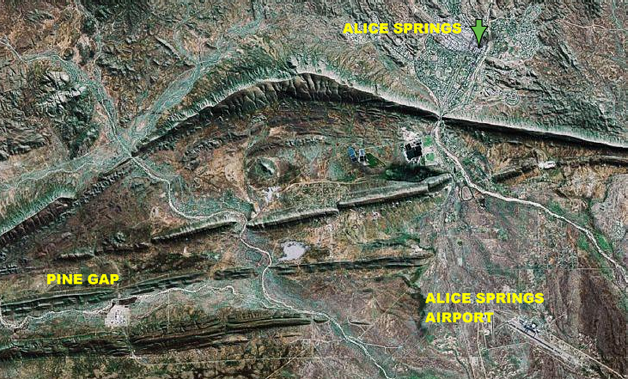
.. View of the Pine Gap Vicinity ..
.. First Warning Sign ..
This is the first sign post as you turn onto Hatt Road, the main road to the Pine Gap facility... |
|||||
|
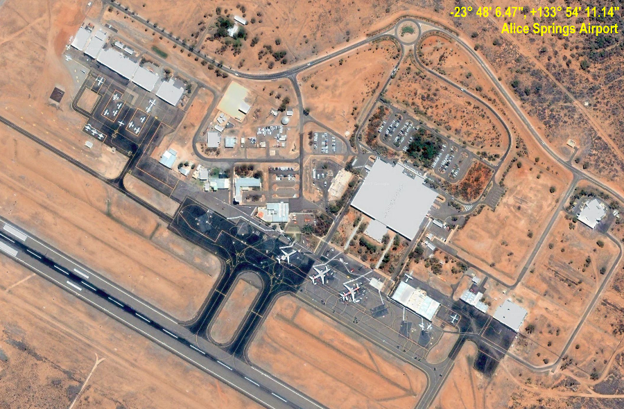
Alice Springs Airport ...
Just as the region is surrounded by mystery and intriguing rock formations, the Alice Springs Airport has also had its own share of intrigue. Built in 1940 by the Department of Defense and used primarily by the Royal Air Transport and the United States Air Force, to bring troops, and supplies into the area. The airport, then called the Seven Mile Aerodrome, quickly became the main transit base for RAAF transport planes during WWII. There were some civilian aircraft, but the main focus was the military, as a major refueling, staging facility for military transport planes, safely stowing the planes away in a neutral area while the war continued to rage in the north. SOURCE: http://www.aliceairport.com.au/
Alice Springs Airport (IATA: ASP, ICAO: YBAS) is a small regional airport 14 kilometres south of Alice Springs in the Northern Territory of Australia. The airport has two runways, the largest of which can accommodate a Boeing 747 or 777 landing (but not a fully laden takeoff due to high temperatures and the runway length). The only scheduled flights using the airport are domestic, although international charters do use the airport on occasions. The airport is not subject to a curfew and operates 24 hours a day. History On 5 October 1921 the first aircraft landed at the original airport located in the Alice Springs township. Connellan Airways (later to become Connair) was based here from 1939. The military buildup in the north of Australia in the late 1930s saw the need for an airport that could take larger and heavier aircraft. This led to the construction of Seven Mile Aerodrome and the diminished role of the Town Site Drome from 1946 until its eventual abandonment in 1968. It is now the site of the Central Australian Aviation Museum. Seven Mile Aerodrome was originally built in 1940 by the Australian Department of Defence and was used primarily by the Royal Australian Air Force and the United States Air Force, to bring troops and supplies into the area. The airport became the main transit base for RAAF transport planes during World War II. Several civilian aircraft were permitted at the airport, but during the war its primary purpose was military as a refuelling and staging facility, as the airport was strategically located near the Pacific Theater of Operations. In 1958 it officially became Alice Springs Airport. The main runway was extended to its present length of 2,438 metres in 1961.
Australian Pine Gap personnel are
exempt from juror
duty (as of 1979). Refer to “1989 No. 185 JURY
EXEMPTION REGULATIONS (AMENDMENT)
- REG 1 Exemptions relating to public
administration”.
SOURCE: See Pine Gap Page 001 |
|||||
|
Pine Gap Security ...
Pine Gap In addition to the
positive aviation security initiatives
underway at Alice Springs Airport, the AFP takes
carriage
Under the Defence Specialist Undertakings (DSU) Act, Pine Gap is classed as a Secure Defence Facility, and is jointly maintained by the Australian and United States Governments. Pine Gap is the
fourth largest employer in Alice Springs,
and Inspector Ken Napier, Station Manager of
Protection
“Despite the tyranny of distance we face, I’m extremely proud of our achievements at Pine Gap, and we will soon see more advances in technology at Pine Gap which will further enhance security.” One such technological advancement
currently in production
is a high-tech screening bay for heavy vehicles such
SOURCE: Policing the Northwest Territories PDF Format Approaching the Gate
The Patch
|
|||||
|
...
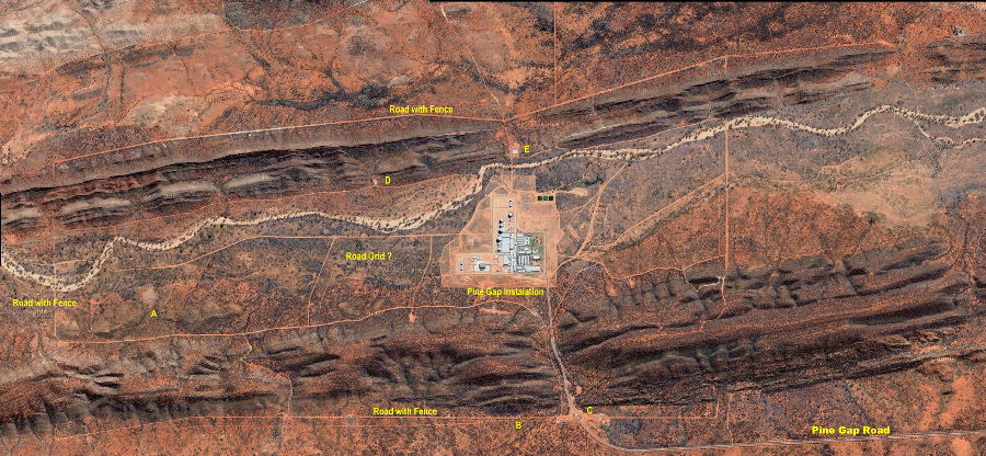
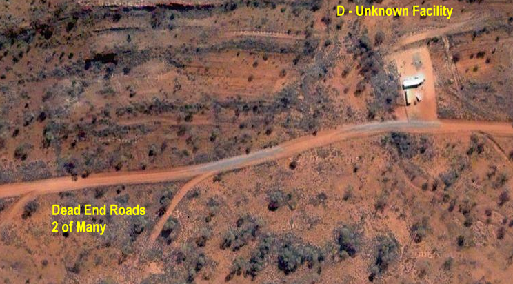
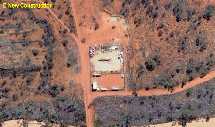
In this overall view of the Pine Gap facility you can see a gridwork of roads laid out in similar fashion to the Manzano Weapons Storage Area [Manzano WSA] at Kirtland AFB in New Mexico. Zooming in you will see the same perimeter fence on a wide dirt roadway (see below). Areas of interest so far annotated are A) A blurry area that looks air brushed; B) A new tunnel entrance into the mountain; C) The main gate area; D) a small facility at base of ridge, may be a new tunnel being started; E) A new back gate post? Pine Gap Perimeter Fence
You can easily make out the fence in this section of the wide cleared roadway that surrounds the Pine Gap Complex. The Complex itself has two more such fences. Pine Gap Main Entry Gate
.. The Gate ..
.. B - The Tunnel into the Mountain ..
First discovered by mungodave, a member of AboveTopSecret.com Post ID thread327853 This entryway is just to the right of the main Gate along the security roadway. The black square seems to be an attempt to hide something, perhaps a vehicle caught entering or leaving the tunnel. This has only been added recently as it did not appear in the previous version of Google Earth |
|||||
|
..
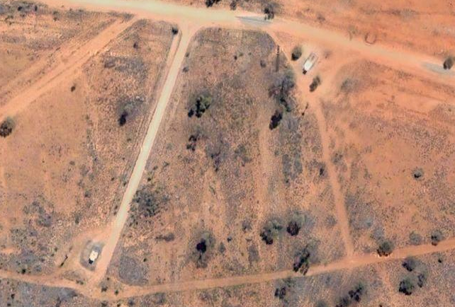
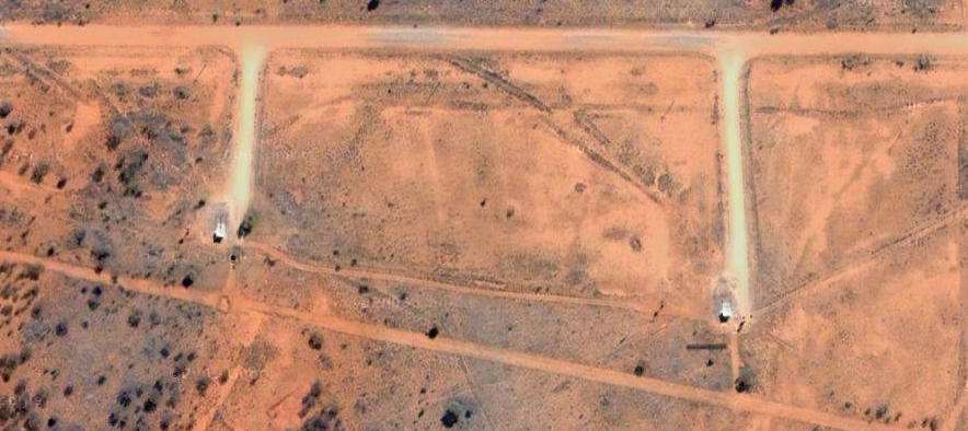
Here is another area of interest...
perhaps the begining
of another tunnel entry. There are two (of several)
dead end roadway. It
is possible that these actually lead into entries as
well. See Kirtland
AFB
files for comparison where we caught images of
the camouflage in
process
..
Another area of interest... New Construction on the road to the North |
|||||
|
...
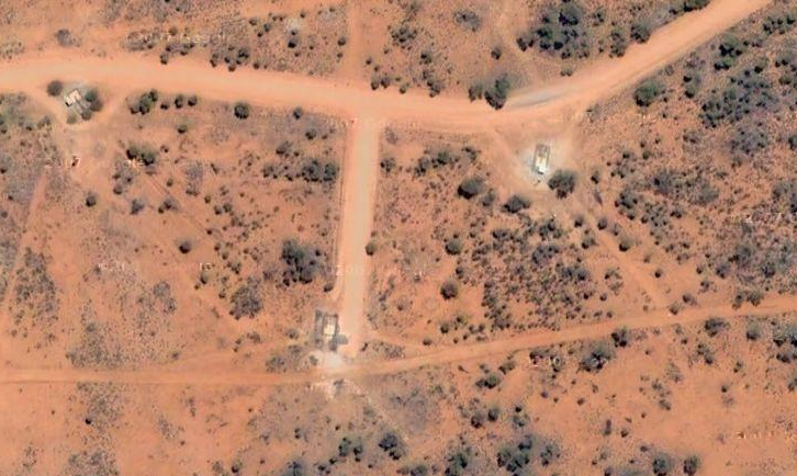
This area is about halfway between
Alice Springs Airport
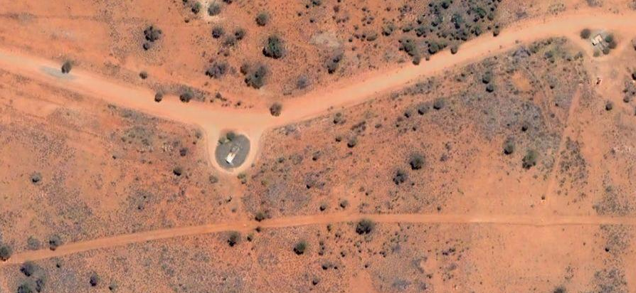
and Pine Gap. Below is a series of closeups of some
of the 'branches' seen
above... So far we do not know what they represent,
though they do not
appear to be in a secured area. Perhaps some local
person could pop over
and have a look?
|
|||||
|
...
|
|||||
| FAIR USE NOTICE: This page contains copyrighted material the use of which has not been specifically authorized by the copyright owner. Pegasus Research Consortium distributes this material without profit to those who have expressed a prior interest in receiving the included information for research and educational purposes. We believe this constitutes a fair use of any such copyrighted material as provided for in 17 U.S.C § 107. If you wish to use copyrighted material from this site for purposes of your own that go beyond fair use, you must obtain permission from the copyright owner. | |||||
|
|


