|
|
||||||||||||||||||||||||||||||||||||||||||||||||||||||||||||||||||||||||||||||||||||||||||||||||||||||||||||||||||||||||||||||||||||||||||||||||||||||||||||||||||||||||||||||||||||||||||||||||||||||||||||||||||||||||||||||||||||||||||||||||||||||||||||||||
|
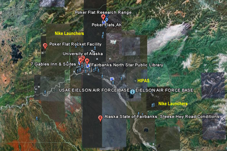
Near Chatanika, Alaska +65° 7' 23.90", -147° 28' 7.05" ..
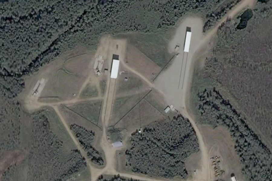
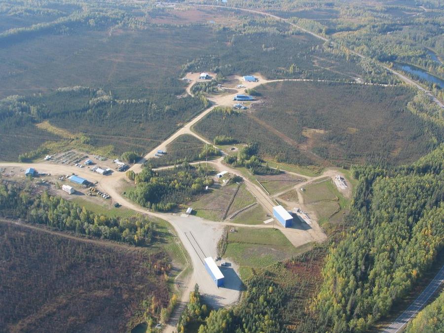
Poker Flat Research Range The Poker Flat Research Range (PFRR) is a launch facility and rocket range for sounding rockets in the U.S. state of Alaska, owned and operated by the University of Alaska Fairbanks (UAF) Geophysical Institute since 1968. The world's largest land-based rocket range, it is situated on a 5,132-acre (20.7 km²) site located approximately 30 miles (48 km) northeast of Fairbanks and is operated under contract to the NASA Wallops Flight Facility. Since its inception PFRR has been closely aligned and funded by the Defense Threat Reduction Agency and its predecessor, the Defense Nuclear Agency (DNA). Other range users include the United States Naval Research Laboratory (NRL) and the Air Force Geophysics Lab (AFGL). More than 1,700 launches have been conducted at the range to study the Earth's atmosphere and the interaction between the atmosphere and the space environment. Areas studied at PFRR include the aurora, plasma physics, the ozone layer, solar proton events, Earth's magnetic field, and ultraviolet radiation. The PFRR originated from University of Alaska auroral research in the 1920s. Sounding rockets were first used for this in 1946. In 1968 the UAF Geophysical Institute leased the land that became the PFRR from the state of Alaska, and the range's facilities were initially completed in 1972 with leadership and vision from Dr. T. Neil Davis. Neil Davis asked Neal Brown to be PFRR's first supervisor and Brown directed the facility from 1971-1989. Construction of new facilities was undertaken in the 1990s with a $30 million grant provided by Congress. Refurbishment of older facilities is an ongoing project.
Related Links:
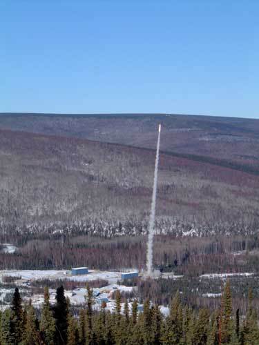
ANCHORAGE — A rocket launched for aurora research Sunday from Poker Flat Research Range malfunctioned and crashed north of Fairbanks. Wreckage from the rocket was spotted in the rocket range's impact zone in the White Mountains. Range manager Greg Walker would not give a specific location for the wreckage. Under normal conditions, the payload would have flown for 40 minutes, peaked above the Arctic Ocean coastline and fallen on the polar ice cap, Walker said. The 70-foot, 2-inch four-stage Black Brant XII rocket reached an altitude of about 18 miles high and flew for five minutes before crashing.
|
||||||||||||||||||||||||||||||||||||||||||||||||||||||||||||||||||||||||||||||||||||||||||||||||||||||||||||||||||||||||||||||||||||||||||||||||||||||||||||||||||||||||||||||||||||||||||||||||||||||||||||||||||||||||||||||||||||||||||||||||||||||||||||||||
|
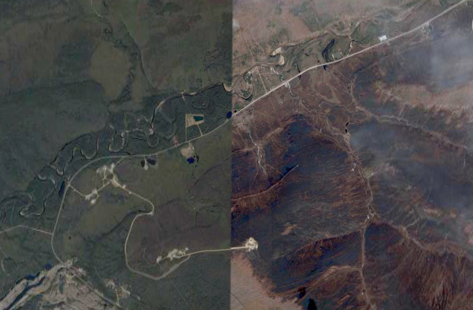
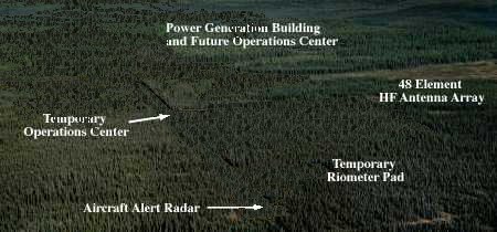
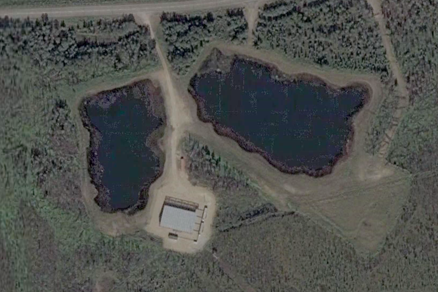
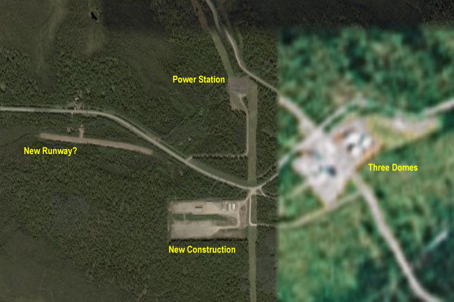
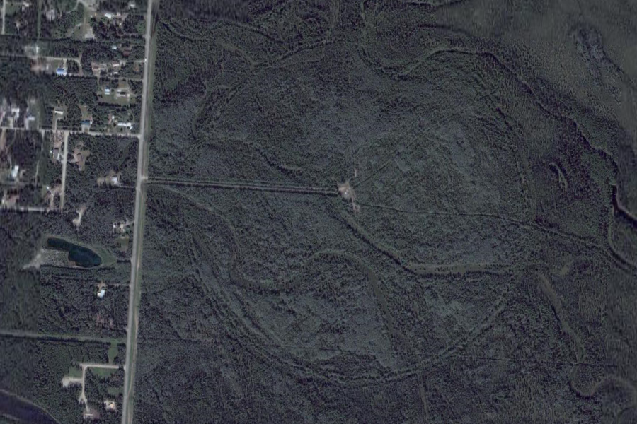
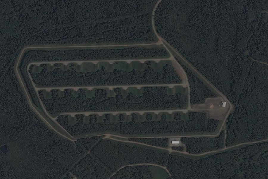
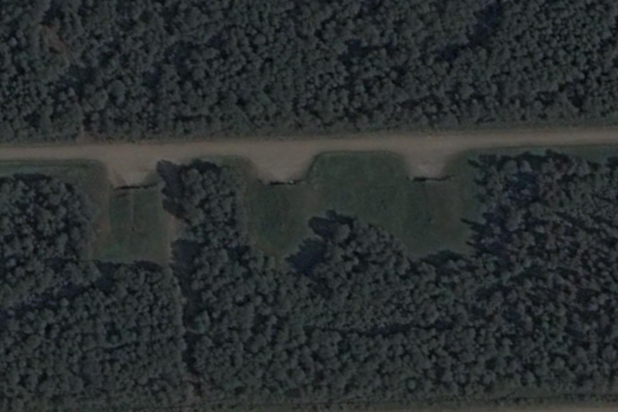
Quite easy with special camouflage techniques This first photo shows HAARP
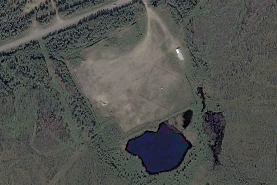
The second photo shows HAARP with a camouflaged Array ..
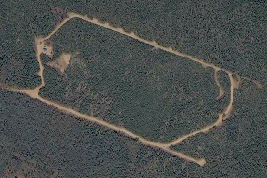
The third image shows a completely concealed array, road and power generation center, to show how easy it is to hide a large facility in a location like Alaska. ..
"The above illustrations demonstrate the capability to effectively conceal large land areas containing hardware and buildings. In a similar initiative comprising the the most comprehensive infrastructure concealment program since World War II, the design team of Dr. Resnick, Lt. Col. Timothy R. O'Neill, PhD (U.S. Army, Ret.) and Mr. Guy Cramer have produced remarkable results. Using specially designed "Fractal Based" camouflage patterns in projects related to concealment of critical infrastructure under the auspices of the US Department of the Interior's Bureau of Land Management, the team continues to achieve desired objectives such as those shown below." SOURCE: Guy Cramer Hyperstealth Tech |
||||||||||||||||||||||||||||||||||||||||||||||||||||||||||||||||||||||||||||||||||||||||||||||||||||||||||||||||||||||||||||||||||||||||||||||||||||||||||||||||||||||||||||||||||||||||||||||||||||||||||||||||||||||||||||||||||||||||||||||||||||||||||||||||
|
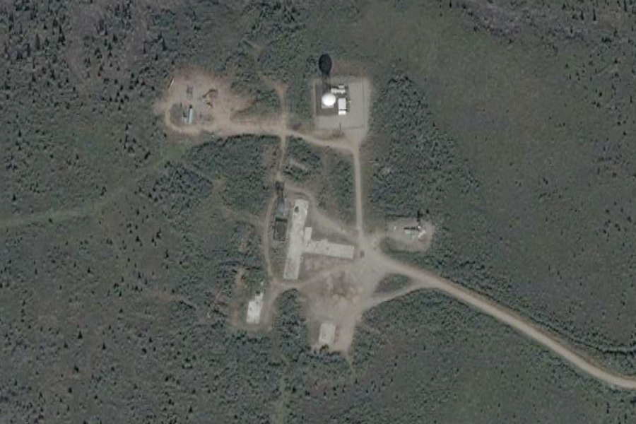
Chatanika Incoherent Scatter Facility HAARP Like Facility ..
+65° 7' 1.34", -147° 27' 37.23" ..
+65° 7' 0.17", -147° 27' 38.93" ..
+65° 7' 3.55", -147° 27' 22.71" ..
+65° 6' 58.68", -147° 27' 57.01" ..
+65° 7' 5.44", -147° 25' 59.59" ..
+65° 7' 38.98", -147° 28' 53.40" |
||||||||||||||||||||||||||||||||||||||||||||||||||||||||||||||||||||||||||||||||||||||||||||||||||||||||||||||||||||||||||||||||||||||||||||||||||||||||||||||||||||||||||||||||||||||||||||||||||||||||||||||||||||||||||||||||||||||||||||||||||||||||||||||||
|
..
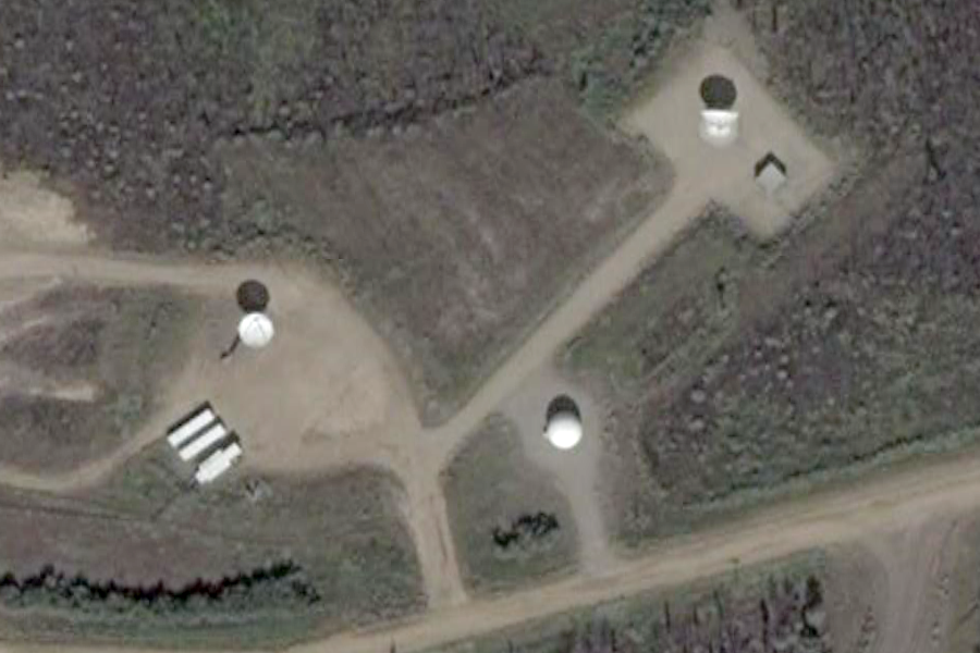
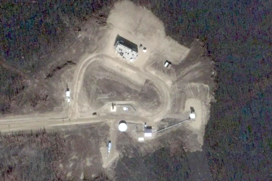
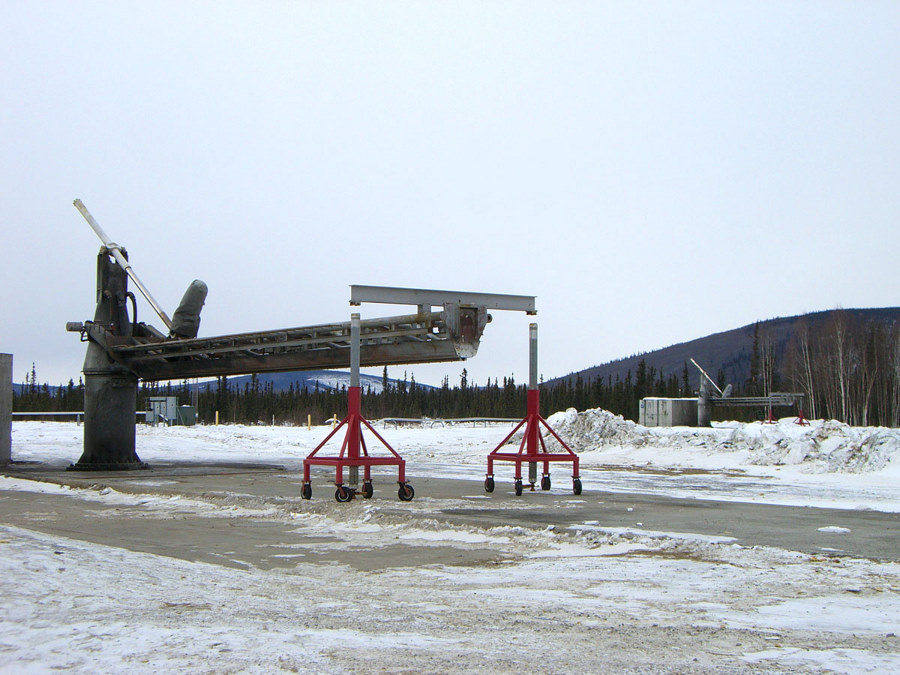
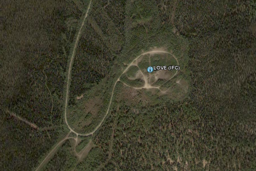
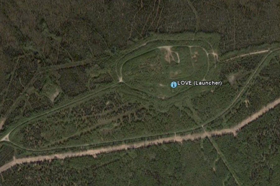
+65° 7' 46.45", -147° 29' 2.05" Poker Flat Research Range has five major launch pads. Pads 1 and 2 each have a 7.5K launcher, pads 3 and 4 each contain 20K MRL launchers, and pad 5 contains a 4K twinboom launcher. Pad 3 and 4 are equipped with moveable launcher enclosures which are used to protect rockets on these pads and the workers from the severe winter weather. The range facilities include an operations and office building, a 40 x 50 foot launch-control blockhouse complex, a 50 x 50 foot payload assembly building with a Class-100 cleanroom, a 285-foot instrumented meteorological tower, minicomputers to calculate wind weight parameters, and other buildings for rocket storage, assembly, and various operations and maintenance functions. Range telemetry support is provided by three S-band auto-track systems, incorporating an 8-foot an 11-meter and a 16-foot dish, provided by NASA and located on Middle Range. PFRR also contains a C-Band NASA Radar for vehicle tracking, surveillance radar for local air traffic, and a meteorological balloon inflation building. Additionally, the range has Transportable Orbital Tracking System (TOTS), the Redstone Antenna, and PF1 (Datalynx) used primarily for satellite tracking. Poker Flat is connected to the Geophysical Institute by means of a digital microwave system which has a 45 Mbit/s (DS3) capacity. The fully-redundant microwave system provides the data channels (including Internet access) and most of the telephone circuits used at PFRR. Poker Flat is also connected via fiber optic link to the Geophysical Institute. The LIDAR Observatory hosts LIDAR (light detection and ranging) experiments, and the T. Neil Davis Science Operations Center, which houses magnetometers, riometers, all-sky auroral cameras, a meridian-scanning photometer, a Fabry-Perot interferometer, and other observing instruments such as the low-light color television camera and video recorder for auroral research. Local tropospheric measurements are made at the Climate Change Monitoring station. Downrange observatories exist at Fort Yukon, Kotzebue, Kaktovik on the Arctic Ocean and Spitzbergen. SOURCE: PFRR Home Site
Daytime rocket launch at Poker Flat Research Range A small band of university employees work year-round at the facility to maintain the physical plant, to provide launch support, and to obtain the various waivers, approvals and agreements necessary to the operation. Past funding sources include the Defense Nuclear Agency, the U.S. Air Force Geophysics Laboratory, the National Science Foundation, and the National Oceanic and Atmospheric Administration. The 5,132-acre site located about 30 miles northeast of Fairbanks, Alaska, is the world's largest, land-based rocket range and has an established chain of downrange flight and observing facilities from inland Alaska to Spitzbergen in the Arctic Ocean for monitoring and recovery purposes More than 1,500 meteorological missiles and 236 major high-altitude sounding rocket experiments have been launched from the range by scientists and technicians from a variety of federal agencies and from universities throughout the world to conduct atmospheric research, including studies on the aurora, ozone layer, solar protons, the electric and magnetic fields, and ultraviolet radiation. The Federal Aviation Administration approves requested rocket flight zones and coordinates air space use during rocket launches. Permission to impact rockets and payloads on some 26 million acres of land is authorized by the Bureau of Land Management, the U.S. Fish and Wildlife Service, the State of Alaska Division of Lands, Doyon, Ltd., and the Village Traditional Councils of Venetie and Arctic Village. The research range launch site is owned by the University of Alaska. - SOURCE
Rocket launchers at Poker Flat Research Range ..
Poker Flats Research Range - Rocket Launch Pads |
||||||||||||||||||||||||||||||||||||||||||||||||||||||||||||||||||||||||||||||||||||||||||||||||||||||||||||||||||||||||||||||||||||||||||||||||||||||||||||||||||||||||||||||||||||||||||||||||||||||||||||||||||||||||||||||||||||||||||||||||||||||||||||||||
|
...
+65° 7' 47.42", -147° 28' 14.15" ..
..
..
..
+65° 4' 11.66", -147° 38' 26.42" ..
+65° 4' 24.03", -147° 38' 23.33" |
||||||||||||||||||||||||||||||||||||||||||||||||||||||||||||||||||||||||||||||||||||||||||||||||||||||||||||||||||||||||||||||||||||||||||||||||||||||||||||||||||||||||||||||||||||||||||||||||||||||||||||||||||||||||||||||||||||||||||||||||||||||||||||||||
| Titre du document / Document title
Three-dimensional measurements of traveling ionospheric disturbances with the Poker Flat Incoherent Scatter Radar Auteur(s) / Author(s) NICOLLS Michael J. (1) ; HEINSELMAN Craig J. (1) ; Affiliation(s) du ou des auteurs / Author(s) Affiliation(s) (1) Center for Geospace Studies, SRI International, Menlo Park, California, ETATS-UNIS Résumé / Abstract [1] In this paper, we present results from the Advanced
Modular Incoherent Scatter Radar (AMISR) installed at the Poker Flat Research
Range near Fairbanks, Alaska, the Poker Flat Incoherent Scatter Radar (PFISR),
that focus on the ability of the system to make three-dimensional, simultaneous
measurements of ionospheric parameters. We present observations from PFISR
where we were able to resolve the three components of the k vector of a
traveling ionospheric disturbance (TID), as well as the period. These measurements
give insight into the atmospheric gravity wave (AGW)-TID relationship,
allowing us to apply a recently developed dispersion relation for AGWs
that includes the role of kinematic viscosity and thermal diffusivity,
important effects in the upper atmosphere, without assumptions about horizontal
wavelengths. The analysis indicates that for this particular case, the
wave must have been propagating against a background wind of ?125 m/s.
PFISR will be a powerful tool for studying the sources and propagation
of waves in the upper atmosphere.
Revue / Journal Title
Geophysical research letters ISSN 0094-8276 CODEN GPRLAJ Source / Source 2007, vol. 34, no21, [Note(s): L21104.1-L21104.6] (1/2 p.) http://cat.inist.fr/?aModele=afficheN&cpsidt=19939758 Poker Flat Incoherent Scatter Radar (PFISR)
High time resolution PFISR and optical observations of naturally enhanced ion acoustic lines http://www.ann-geophys.net/27/1457/2009/angeo-27-1457-2009.pdf Advanced Modular Incoherent Scatter Radar (AMISR)
|
||||||||||||||||||||||||||||||||||||||||||||||||||||||||||||||||||||||||||||||||||||||||||||||||||||||||||||||||||||||||||||||||||||||||||||||||||||||||||||||||||||||||||||||||||||||||||||||||||||||||||||||||||||||||||||||||||||||||||||||||||||||||||||||||
|
National Weather Service Enhanced Radar Image Pedro Dome, AK Radar +65° 2' 6.61", -147° 30' 5.31" ..
Pedro Dome, AK Radar Current Readings Pedro Dome - PAPD
This contains the locations of all of the National Weather Service doppler radars available for viewing on GRLevel3... for weather nerds like me to enjoy. Radars were located visually in higher resolution areas and by lat/lon coordinates in low resolution areas. Most of the towers are white, but oddly enough a few are brown and I found at least one black one. NWS Radar Towers |
||||||||||||||||||||||||||||||||||||||||||||||||||||||||||||||||||||||||||||||||||||||||||||||||||||||||||||||||||||||||||||||||||||||||||||||||||||||||||||||||||||||||||||||||||||||||||||||||||||||||||||||||||||||||||||||||||||||||||||||||||||||||||||||||
|
+64° 57' 7.17", -148° 21' 26.33" ..
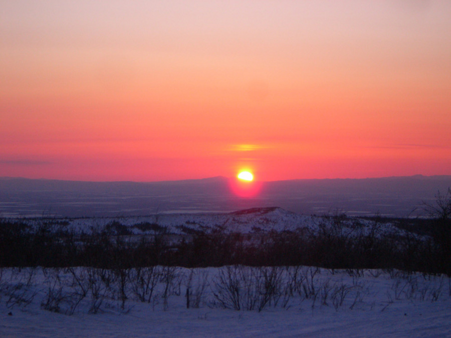
Sunset on top of Murphy Dome. |
||||||||||||||||||||||||||||||||||||||||||||||||||||||||||||||||||||||||||||||||||||||||||||||||||||||||||||||||||||||||||||||||||||||||||||||||||||||||||||||||||||||||||||||||||||||||||||||||||||||||||||||||||||||||||||||||||||||||||||||||||||||||||||||||
|
Beam plan: ..
System type: IRIS (Filled-array)
|
||||||||||||||||||||||||||||||||||||||||||||||||||||||||||||||||||||||||||||||||||||||||||||||||||||||||||||||||||||||||||||||||||||||||||||||||||||||||||||||||||||||||||||||||||||||||||||||||||||||||||||||||||||||||||||||||||||||||||||||||||||||||||||||||
|
..
|
||||||||||||||||||||||||||||||||||||||||||||||||||||||||||||||||||||||||||||||||||||||||||||||||||||||||||||||||||||||||||||||||||||||||||||||||||||||||||||||||||||||||||||||||||||||||||||||||||||||||||||||||||||||||||||||||||||||||||||||||||||||||||||||||
|
..
|
||||||||||||||||||||||||||||||||||||||||||||||||||||||||||||||||||||||||||||||||||||||||||||||||||||||||||||||||||||||||||||||||||||||||||||||||||||||||||||||||||||||||||||||||||||||||||||||||||||||||||||||||||||||||||||||||||||||||||||||||||||||||||||||||
|
..
|
||||||||||||||||||||||||||||||||||||||||||||||||||||||||||||||||||||||||||||||||||||||||||||||||||||||||||||||||||||||||||||||||||||||||||||||||||||||||||||||||||||||||||||||||||||||||||||||||||||||||||||||||||||||||||||||||||||||||||||||||||||||||||||||||
|
..
|
||||||||||||||||||||||||||||||||||||||||||||||||||||||||||||||||||||||||||||||||||||||||||||||||||||||||||||||||||||||||||||||||||||||||||||||||||||||||||||||||||||||||||||||||||||||||||||||||||||||||||||||||||||||||||||||||||||||||||||||||||||||||||||||||
|
..
..
+64° 35' 10.80", -146° 43' 49.11" ..
+64° 34' 54.73", -146° 45' 7.75" ..
+64° 40' 25.22", -146° 45' 4.81" ..
+64° 40' 38.64", -146° 45' 52.86" ..
+64° 37' 15.90", -146° 34' 20.57" ..
+64° 37' 21.85", -146° 38' 52.79" ..
+64° 32' 36.32", -146° 49' 45.07" |
||||||||||||||||||||||||||||||||||||||||||||||||||||||||||||||||||||||||||||||||||||||||||||||||||||||||||||||||||||||||||||||||||||||||||||||||||||||||||||||||||||||||||||||||||||||||||||||||||||||||||||||||||||||||||||||||||||||||||||||||||||||||||||||||
|
....
+64° 31' 37.90", -146° 57' 47.71" ..
+64° 32' 7.57", -146° 59' 23.58" ..
+64° 39' 24.80", -147° 5' 16.05" ..
+64° 48' 35.56", -147° 21' 51.00" ..
+64° 51' 35.81", -147° 33' 18.43" ..
+64° 51' 35.81", -147° 33' 18.43" ..
+64° 49' 58.11", -147° 38' 8.34" ..
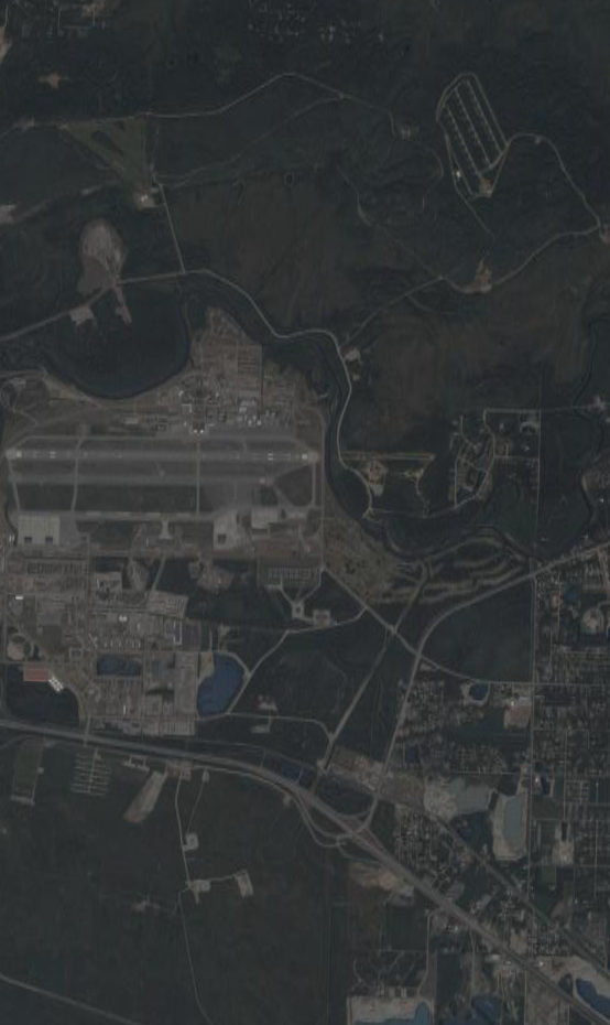
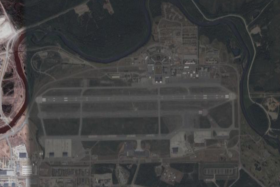
+64° 49' 58.11", -147° 38' 8.34" Ladd Army Airfield is the military airfield located at Fort Jonathan Wainwright, located in Fairbanks, Alaska. It was originally called Ladd Field, in honor of Major Arthur K. Ladd, a pilot in the U.S. Army Air Corps who died in a South Carolina plane crash in 1935. The U.S. government began, for the first time, serious infrastructure expenditures in Alaska during the 1930s. Most prominent was an increase in the military presence. For most of the early 20th century, the only Army post in Alaska was Chilkoot Barracks/Fort Seward, located just outside of Haines. With the threat of war looming as the 1930s ended, the need was established to develop multiple facilities as a means of defending Alaska against possible enemy attack. The U.S. government acquired homesteads southeast of the town of Fairbanks beginning in 1938. From this land, totalling about 6 square miles, was created Ladd Field. Major construction of facilities began in 1941 and 1942, after the U.S. entered World War II. The initial construction occurred several miles from Fairbanks along a bend of the Chena River, consisting of an airfield, hangars, housing and support buildings. Many of these buildings still stand today. Ladd Field's primary role during WWII was as a major stopping point for the Lend-Lease program, which ferried Allied planes to Russia across the Bering Strait. For most of its early history Ladd was an Air Force installation. At the time it opened, the Air Force was still a part of the Army. When the Air Force was made a separate branch in the late 1940s, the name was changed to Ladd Air Force Base. For many years, it would be one of two Air Force bases in the Fairbanks area. 26 Mile Field, originally a satellite field to Ladd, was designated Eielson Air Force Base in 1947.
|
||||||||||||||||||||||||||||||||||||||||||||||||||||||||||||||||||||||||||||||||||||||||||||||||||||||||||||||||||||||||||||||||||||||||||||||||||||||||||||||||||||||||||||||||||||||||||||||||||||||||||||||||||||||||||||||||||||||||||||||||||||||||||||||||
+64° 59' 3.07", -147° 53' 11.98" ..
+64° 58' 20.60", -147° 54' 38.81" |
||||||||||||||||||||||||||||||||||||||||||||||||||||||||||||||||||||||||||||||||||||||||||||||||||||||||||||||||||||||||||||||||||||||||||||||||||||||||||||||||||||||||||||||||||||||||||||||||||||||||||||||||||||||||||||||||||||||||||||||||||||||||||||||||
| FAIR USE NOTICE: This page contains copyrighted material the use of which has not been specifically authorized by the copyright owner. Pegasus Research Consortium distributes this material without profit to those who have expressed a prior interest in receiving the included information for research and educational purposes. We believe this constitutes a fair use of any such copyrighted material as provided for in 17 U.S.C § 107. If you wish to use copyrighted material from this site for purposes of your own that go beyond fair use, you must obtain permission from the copyright owner. | ||||||||||||||||||||||||||||||||||||||||||||||||||||||||||||||||||||||||||||||||||||||||||||||||||||||||||||||||||||||||||||||||||||||||||||||||||||||||||||||||||||||||||||||||||||||||||||||||||||||||||||||||||||||||||||||||||||||||||||||||||||||||||||||||
|
|
