|
Star Wars Weapons |
|||||||
|
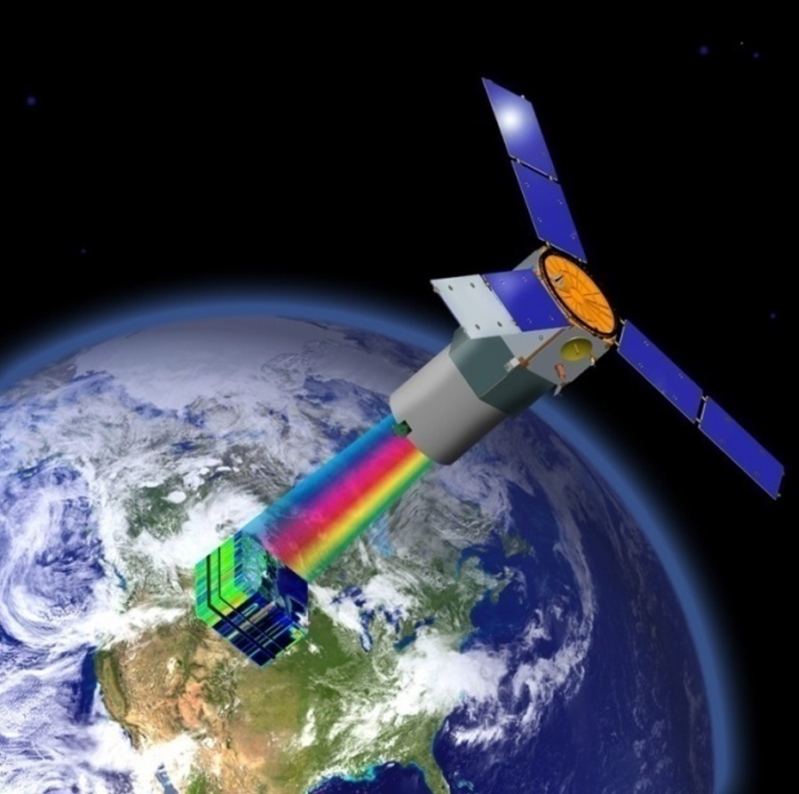
Advanced Responsive Tactically Effective Military Imaging Spectrometer - TacSat-3 Hyperspectral Cube
New prototype US spy satellite
rushed into active use
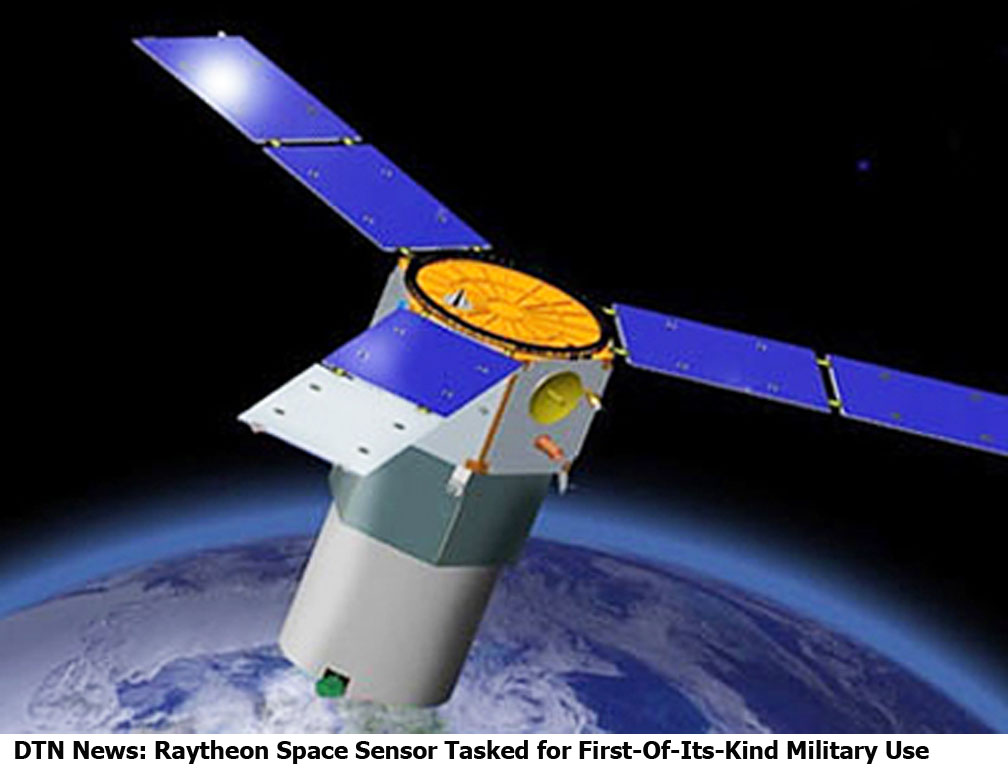
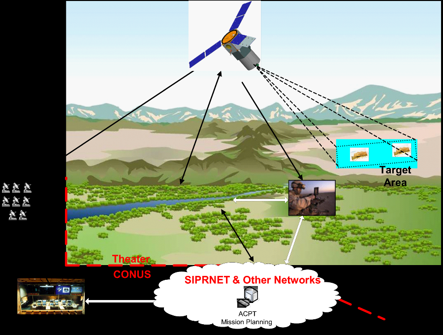
An experimental "hyperspectral" spy sat which is able to detect buried roadside bombs and concealed cave or tunnel entrances has been handed over to the US forces for operational use in the Wars on Stuff. The TacSat-3 was launched aboard a Minotaur-1 rocket along with several other small satellites from Wallops Island, Virginia, in May 2009. The TacSat was designed to prove the US concept of "operationally responsive space", where a military user can make a request and a small inexpensive satellite can be in a suitable orbit within days rather than months or years. Thus the TacSat is designed to be fitted with a variety of different payloads as required by an operational commander. TacSat-3, as a prototype, carried one in particular known as the Advanced Responsive Tactically Effective Military Imaging Spectrometer, or ARTEMIS. This is a "hyperspectral" sensor able to detect not just visible light but infrared and ultraviolet as well. The idea of hyperspectral sensing is not, however, merely to "see" in the usual sense of optical telescopes, infrared nightscopes and/or thermal imagers. This kind of detection is used on spy satellites and other surveillance systems, but it suffers from the so-called "drinking straw effect" - that is, you can only view a small area in enough detail to pick out information of interest. It's impossible to cover an entire nation or region in any length of time by such means; you have to know where to look in advance. Hyperspectral imaging works differently. It's based on the same principle as the spectrometry used in astronomy and other scientific fields - that some classes of objects and substances will emit a unique set of wavelengths when stimulated by energy. In this case, everything on the surface below the satellite is being stimulated by sunlight to emit its unique spectral fingerprint. SOURCE: The Register Sifting the 'hyperspectral cube' By scanning across a wide spectrum all at once across a wide area, it's then possible to use a powerful computer to crunch through all wavelengths coming from all points on the surface below (the so-called "hyperspectral cube", made up of the full spectrum coming from all points on a two-dimensional surface). If the sensor is good enough and the computer crunching powerful and discriminating enough, the satellite can then identify a set of points on the surface where substances or objects of interest are to be found, and supply map coordinates for these. This is a tiny amount of data compared to the original "hyperspectral cube" generated by ARTEMIS and crunched by the satellite's onboard processors, and as such it can be downloaded to a portable ground terminal (rather than a one with a big high-bandwidth dish). Within ten minutes of the TacSat passing overhead, laptop-sized ROVER ground terminals can be marking points of interest on a map for combat troops nearby. Exactly what sorts of objects and substances ARTEMIS is able to pick out of its region-spanning hyperspectral cubes is a military secret. However this briefing pdf given in 2006 by US airforce lab officials suggests that it was expected to pierce overhead camouflage that would deceive optical or thermal sensing; that it would be able to spot disturbed earth and "concealed adits" (that is cave or tunnel entrances invisible from above) and generally "detect and identify" unspecified "targets". Evidently the TacSat-3 can do at least some of this, as we now learn that following a year as an experiment it has proved so successful that it is now being handed over to US air force Space Command to become a full-time operational asset - America's first hyperspectral spy sat. "ARTEMIS can detect various man-made and natural materials, which adds a fundamentally new capability," according to Bill Hart, veep at ARTEMIS maker Raytheon. TacSat-3 has "demonstrated the utility of hyperspectral information to benefit soldiers, sailors, airmen and Marines around the world," says Dr Peter Wegner, chief of the Operationally Responsive Space office at the Pentagon, in a statement issued yesterday. It's quite unusual for a military prototype to be put straight into frontline service like this; furthermore we're told that ARTEMIS data has already been "used operationally" even while the TacSat-3 was under control of the airforce research lab. All this would seem to indicate that hyperspectral spy sats are set to become a significant new player in the surveillance and spookery world. Even more than ever, you may watch the skies - but the skies will be watching you back. And you can forget about relying on your insulated camouflage netting or your overhung tunnel entrance which never shows a shadow, or your buried bomb or weapons cache. ARTEMIS and its successors will sniff you out, perhaps, even if thus far you have remained completely unseen SOURCE: The Register Related Links:
|
|||||||
|
..
(NSI News Source Info) EL SEGUNDO,
Calif.
Raytheon Company's (NYSE: RTN) hyperspectral imaging sensor known as ARTEMIS is being prepared for a first-of-its-kind tactical military role by the Air Force Space Command. The company's Advanced Responsive Tactically Effective Military Imaging Spectrometer has successfully completed its one-year experimental mission aboard the Air Force Research Laboratory's Tactical Satellite-3. Based on the success of that mission, Raytheon has been notified that the Air Force Space Command will take control of TacSat-3 with the intent to use ARTEMIS in an operational capacity. "The ARTEMIS hyperspectral imager gives military commanders an important new advantage in the asymmetric battlefield," said Bill Hart, vice president for Raytheon Space Systems. "ARTEMIS can detect various man-made and natural materials, which adds a fundamentally new capability for the DoD." Unlike visible imagers, hyperspectral
sensors capture light across a wide swath of the electromagnetic spectrum,
providing unprecedented spectral detail. That spectral information produces
a distinct "signature," which can be compared against the spectral signatures
of known objects to rapidly identify potential areas of interest.
"Air Force Space Command looks forward to taking ownership of the TacSat-3 ARTEMIS system," said Lt. Col. Ryan Pendleton, Air Force Space Command, Chief, Operationally Responsive Space Integration. "We plan to operationalize the system as soon as possible to provide direct benefit to warfighters." TacSat-3 originated as part of the U.S. Department of Defense's operationally responsive space initiative, which seeks to give field commanders flexible, affordable options for obtaining real-time tactical surveillance data from space. Aided by the ORS Office, and led by the Air Force Research Laboratory, the TacSat-3 program was designed to demonstrate the feasibility of developing and launching a military payload within extremely tight schedule and budget constraints. "TacSat-3 has been a pathfinder to explore concepts of operation for future ORS systems and demonstrates how great things can be achieved on a small budget and in a short time," said Dr. Peter Wegner, director of the Pentagon's ORS Office. "It has also demonstrated the utility of hyperspectral information to benefit soldiers, sailors, airmen and Marines around the world." Raytheon is discussing with several government customers opportunities for rapidly deploying additional hyperspectral space sensors. "Based on our experience on TacSat-3, we're ready to build operational hyperspectral systems like ARTEMIS quickly and affordably," said Raytheon's Hart. Raytheon Company, with 2009 sales of $25 billion, is a technology and innovation leader specializing in defense, homeland security and other government markets throughout the world. With a history of innovation spanning 88 years, Raytheon provides state-of-the-art electronics, mission systems integration and other capabilities in the areas of sensing; effects; and command, control, communications and intelligence systems, as well as a broad range of mission support services. With headquarters in Waltham, Mass., Raytheon employs 75,000 people worldwide. Contact:
SOURCE: DTN News / Raytheon Raytheon Press Release June 10,
2010
EL SEGUNDO, Calif., June 10, 2010 /PRNewswire/ -- Raytheon Company's (NYSE: RTN) hyperspectral imaging sensor known as ARTEMIS is being prepared for a first-of-its-kind tactical military role by the Air Force Space Command. The company's Advanced Responsive Tactically Effective Military Imaging Spectrometer has successfully completed its one-year experimental mission aboard the Air Force Research Laboratory's Tactical Satellite-3. Based on the success of that mission, Raytheon has been notified that the Air Force Space Command will take control of TacSat-3 with the intent to use ARTEMIS in an operational capacity. "The ARTEMIS hyperspectral imager gives military commanders an important new advantage in the asymmetric battlefield," said Bill Hart, vice president for Raytheon Space Systems. "ARTEMIS can detect various man-made and natural materials, which adds a fundamentally new capability for the DoD." Unlike visible imagers, hyperspectral sensors capture light across a wide swath of the electromagnetic spectrum, providing unprecedented spectral detail. That spectral information produces a distinct "signature," which can be compared against the spectral signatures of known objects to rapidly identify potential areas of interest. The ARTEMIS hyperspectral imager combines spectral information with geo-location coordinates in an easy-to-read map. This information is then sent directly to troops on the ground in near real time. "Air Force Space Command looks forward to taking ownership of the TacSat-3 ARTEMIS system," said Lt. Col. Ryan Pendleton, Air Force Space Command, Chief, Operationally Responsive Space Integration. "We plan to operationalize the system as soon as possible to provide direct benefit to warfighters." TacSat-3 originated as part of the U.S. Department of Defense's operationally responsive space initiative, which seeks to give field commanders flexible, affordable options for obtaining real-time tactical surveillance data from space. Aided by the ORS Office, and led by the Air Force Research Laboratory, the TacSat-3 program was designed to demonstrate the feasibility of developing and launching a military payload within extremely tight schedule and budget constraints. "TacSat-3 has been a pathfinder to explore concepts of operation for future ORS systems and demonstrates how great things can be achieved on a small budget and in a short time," said Dr. Peter Wegner, director of the Pentagon's ORS Office. "It has also demonstrated the utility of hyperspectral information to benefit soldiers, sailors, airmen and Marines around the world." Raytheon is discussing with several government customers opportunities for rapidly deploying additional hyperspectral space sensors. "Based on our experience on TacSat-3, we're ready to build operational hyperspectral systems like ARTEMIS quickly and affordably," said Raytheon's Hart. Raytheon Company, with 2009 sales of $25 billion, is a technology and innovation leader specializing in defense, homeland security and other government markets throughout the world. With a history of innovation spanning 88 years, Raytheon provides state-of-the-art electronics, mission systems integration and other capabilities in the areas of sensing; effects; and command, control, communications and intelligence systems, as well as a broad range of mission support services. With headquarters in Waltham, Mass., Raytheon employs 75,000 people worldwide. Contact:
John_Barksdale@raytheon.com SOURCE: Raytheon Company |
|||||||
|
..
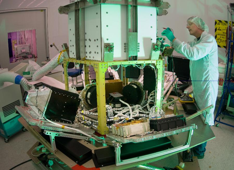
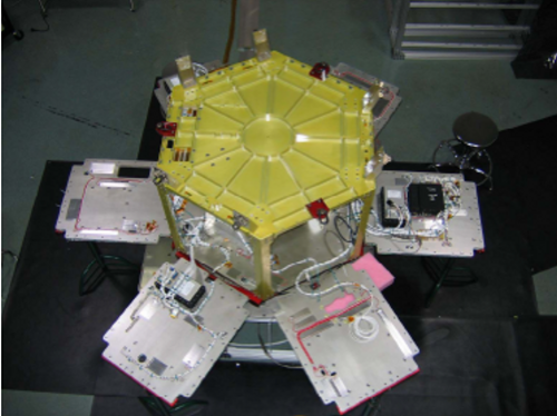
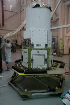
TacSat-3 is the third in a series of U.S. military reconnaissance satellites. It was assembled in an Air Force Research Laboratory Space Vehicles Directorate facility at Kirtland Air Force Base, New Mexico.[2] The TacSat satellites are all designed to demonstrate the ability to provide real-time data collected from space to combatant commanders in the field. TacSat-3 includes three distinct payloads: the Advanced Responsive Tactically Effective Military Imaging Spectrometer (ARTEMIS) hyperspectral imager, the Ocean Data Telemetry Microsatellite Link and the Space Avionics Experiment.[3]
Design TacSat-3 uses a standard satellite bus developed and provided by ATK. The payload consists of a two mirror Ritchey?Chrétien telescope plus correction optics, with a focus device incorporated in the secondary mirror unit, and with a slit Offner spectrometer. The spectrometer uses the ARTEMIS hyperspectral imaging sensor (HSI), which is a single HgCdTe Focal Plane Array covering the entire V/NIR/SWIR spectrum from 400 nm to 2500 nm at a uniform resolution of 5 nm. ARTEMIS measures first the spectral information at each point on the ground in 400 spectral channels. HSI data cubes obtained by ARTEMIS are then handled by a reprogrammable digital signal processor with 16 GB data storage capability to generate on-board products and for in-theater downlink.[4][5] TacSat-3's main focus is land-based HSI.[6] According to Peter Wegner from the Operationally Responsive Space Office, TacSat-3 cost US$90 million [7]
..
..
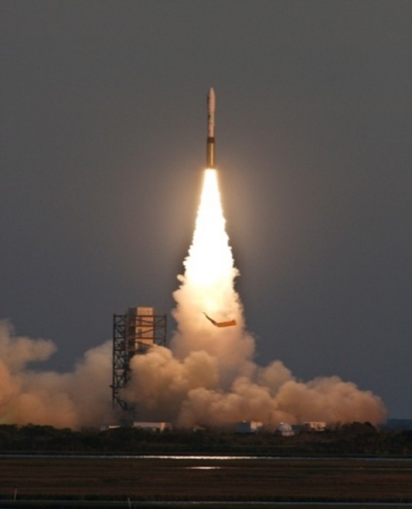
Launch history In January 2009 the Air Force announced that a malfunctioning component has postponed the launch date on its Minotaur rocket.[8] However, in March 2009 it was announced that the component issues had been resolved and a launch date was set for May 5, 2009.[9] The May 5 launch attempt was scrubbed and a new launch date was set for May 19, with a backup date of May 20. The launch occurred successfully at 23:55 UTC on 19 May, 20 minutes into a launch window running from 23:35 to 03:30 (7:35 PM to 11:30 PM local time) each night.[10] The first attempt to launch TacSat-3 was made on 6 May, during a window running from 00:00-03:00 UTC (20:00-23:00 local time on 5 May). However, due to thunderstorms and very low ceilings which prevented the surveillance plane from taking off, this launch attempt was scrubbed and the next attempt was scheduled for May 8 during the same window. The May 8th attempt was also scrubbed due to thunderstorms and heavy rain, which once again, prevented the surveillance plane from being able to take off. Another attempt was scheduled for the next day on May 9, again with the same window. Although the weather cooperated better for the May 9th attempt, a launch support equipment problem caused a delay of approximately three hours past the scheduled launch time. This problem was resolved and the countdown resumed. However, with 2 minutes and 16 seconds left on the countdown clock, an unexpected hold was called.[11] Several minutes later, this launch attempt was also scrubbed due to low electrical voltage on the AGC of the Flight Termination System. A new launch date was set for May 19 with May 20 as a backup date. The spacecraft was successfully launched at 23:55 UTC on May 19, 2009 after a small delay to remove off shore boaters from the exclusion area.
Author: Gary Payton, Deputy Under Secretary, Air Force Space Programs Mission TacSat-3 achieves a HSI ground resolution of 4 meter, which enables it to detect and identify tactical targets.[12] After a successful completion of a one year experimental phase, and the acquisition of more than 2100 images, TacSat-3 was handed over to the Air Force in June 2010 as a full-time operational asset. It is the first hyperspectral satellite with the ability to provide reconnaissance within 10 minutes after passing overhead. Field commanders, using, e.g., a AN/PRC-117F manpack military radio can directly communicate with the satellite in the ultrahigh frequency band.[13][14][15] TacSat-3/ARTEMIS observations of the National Mall and the Kilauea Volcano to support technical validation of the sensor have been released in June 2010. The released images comprise three of the more than 400 spectral bands.[16]
References:
|
|||||||
| FAIR USE NOTICE: This page contains copyrighted material the use of which has not been specifically authorized by the copyright owner. Pegasus Research Consortium distributes this material without profit to those who have expressed a prior interest in receiving the included information for research and educational purposes. We believe this constitutes a fair use of any such copyrighted material as provided for in 17 U.S.C § 107. If you wish to use copyrighted material from this site for purposes of your own that go beyond fair use, you must obtain permission from the copyright owner. | |||||||
|
|
