|
|
|||||
Johnston
Atoll
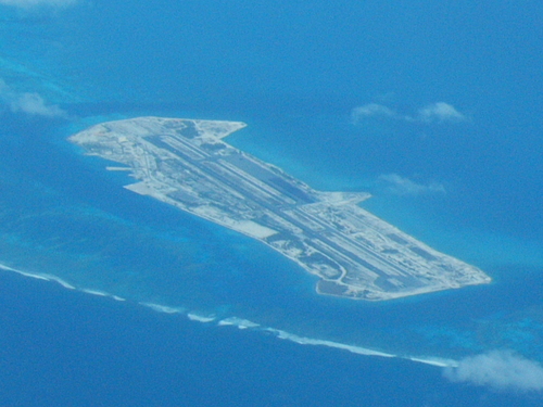
Johnston Atoll is a 130 km² atoll in the North Pacific Ocean at 16°45′N 169°31′W / 16.75, -169.517] about 1400 kilometers (750 nm) west of Hawaii. There are four islands located on the coral reef platform, two natural islands, Johnston Island and Sand Island, which have been expanded by coral dredging, as well as North Island (Akau) and East Island (Hikina), an additional two artificial islands formed by coral dredging. The four islands comprise a total land mass of 2.67 km². Due to the atoll's tilt, much of the reef on the south-east portion has subsided. But even though it does not have an encircling reef crest, the reef crest on the north-west portion of the atoll does provide for a shallow lagoon, with depths ranging from 3-10 m. Johnston is an unincorporated territory of the United States, administered by the U.S. Fish and Wildlife Service of the Department of the Interior as part of the United States Pacific Island Wildlife Refuges. For statistical purposes, Johnston Atoll is grouped as one of the United States Minor Outlying Islands. Its climate is tropical but generally dry. North-east trade winds are consistent and there is little seasonal temperature variation.[1] With elevation ranging from sea level to 5 m at Summit Peak, the islands contain some low-growing vegetation on mostly flat terrain and no natural fresh water resources. SOURCE
Wikipedia: Johnston
Atoll
Johnston Atoll
On 31 July 2001 the U.S. Army Chemical Activity Pacific retired its colors on Johnston Island. The unit’s deactivation marked an end to 30 years of storing and handling chemical weapons stockpiles, and participating in the destruction of those weapons since 1990. Johnston Island, 825 miles southwest of Hawaii, was the only site where soldiers were entirely responsible for the storage, security and transport of the deadly chemical agents. Department of Defense contractors run eight other sites throughout the United States. The island, only 2½ miles long and a half-mile wide, was home to a military police company and chemical company, along with a headquarters unit. Every soldier assigned to the island during the 30 years chemicals were stored there received special training in handling and emergency responses to chemical agents. The unit safeguarded and disposed of deadly sarin and VX nerve agents and assisted the Johnston Atoll Chemical Disposal System, a contract civilian group assigned to destroy the chemical agents. The two units destroyed more than 400,000 rockets, bombs, projectiles, mortars and mines. Two thousand tons of nerve and blister agent were also destroyed. The last of the chemical stockpile was destroyed in November 2000. There were no incidents or accidents in the unit’s 30-year history. The last soldier left Johnston Island by ship on 17 August 2001, but some DOD contract civilians will remain. The Johnston Atoll Chemical Disposal System will continue to be dismantled and dispose of secondary hazardous waste from the chemical weapons destruction. That operation is scheduled to end in 2004. SOURCE: Global Security
...
|
|||||
|
Johnston
Atoll Updates
1990
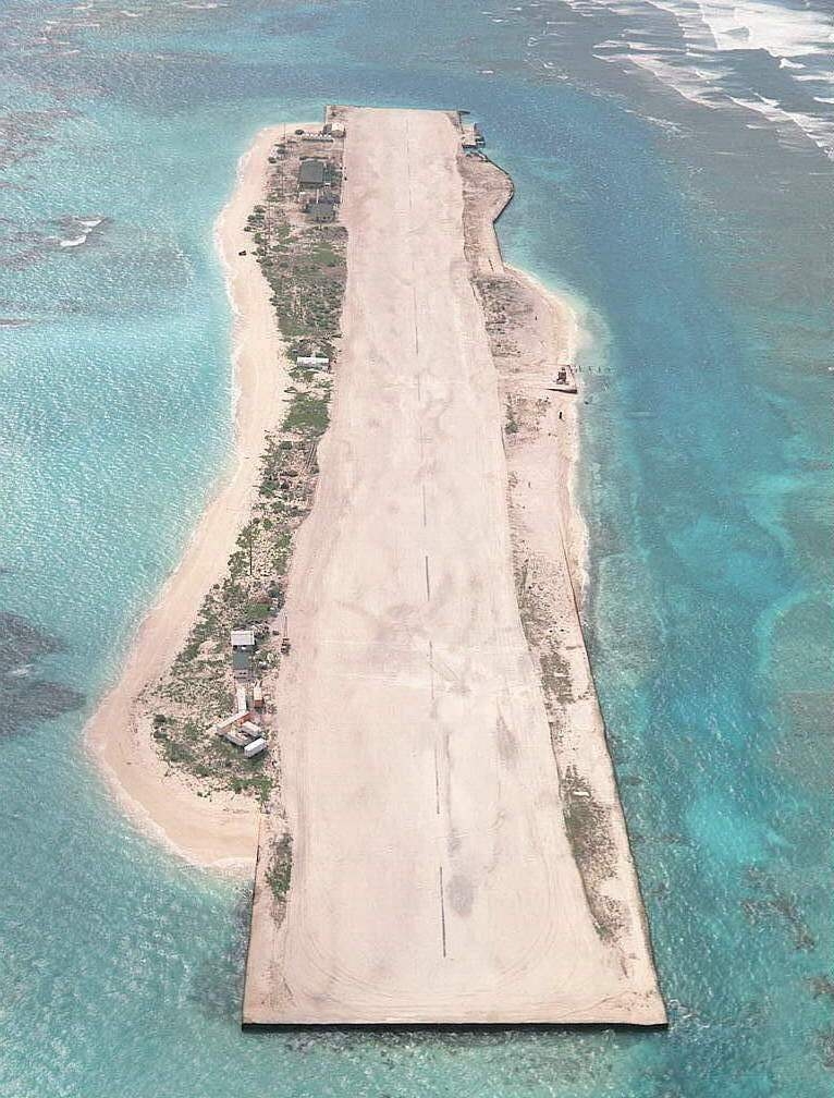
Sand Island and former U.S. Coast Guard LORAN Station. SSgt. Val Gempis, USAF - U.S. DefenseImagery photo VIRIN: DF-ST-92-02431 An aerial view of Johnston Atoll. 1 November 1990
|
|||||
| Johnston
Atoll Updates 2011
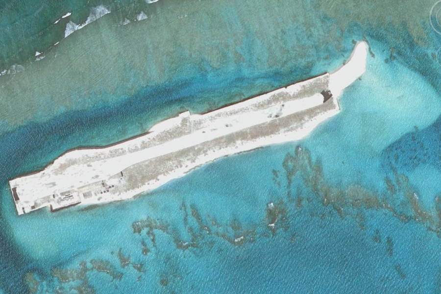
Aerial approach to the former base on
Johnston Island (top). The ship channel is visible as a darker blue area
starting at left and continuing up around the right side of Johnston
Island, with Sand Island on the near side (bottom). Taken on December
25, 2011 by Colmeister
|
|||||
| Related Links: |
|||||
|
French Frigate Shoals ..
The French Frigate Shoals (Hawaiian: Kānemilohaʻi) is the largest atoll in the Northwestern Hawaiian Islands. Its name commemorates French explorer Jean-François de La Pérouse, who nearly lost two frigates when attempting to navigate the shoals. It consists of a 20-mile (32 km) long crescent-shaped reef, twelve sandbars, and the 120 feet (36 m) high La Perouse Pinnacle, the only remnant of its volcanic origins. The total land area of the islets is 61.508 acres (248,910 m2). Total coral reef area of the shoals is over 232,000 acres (940 km2). Tern Island, with an area of 26.014 acres (105,270 m2), has a landing strip and permanent habitations for a small number of people. It is maintained as a field station in the Hawaiian Islands National Wildlife Refuge by the United States Fish and Wildlife Service. The French Frigate Shoals are about 487 nautical miles (902 km/560 mi) northwest of Honolulu. SOURCE: Wikipedia.org/wiki/French_Frigate_Shoals
...
...
|
|||||
| FAIR USE NOTICE: This page contains copyrighted material the use of which has not been specifically authorized by the copyright owner. Pegasus Research Consortium distributes this material without profit to those who have expressed a prior interest in receiving the included information for research and educational purposes. We believe this constitutes a fair use of any such copyrighted material as provided for in 17 U.S.C § 107. If you wish to use copyrighted material from this site for purposes of your own that go beyond fair use, you must obtain permission from the copyright owner. | |||||
|
|


