|
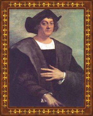
1451-1506
Italian navigator and discoverer of the New World (1451
- 1506).
|
|
1451-1506
Italian navigator and discoverer of the New World (1451
- 1506).
|
|
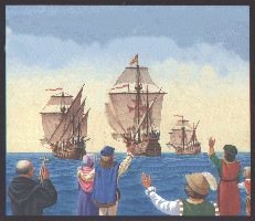
and Discovery of the New World THE FIRST VOYAGE Columbus sailed from Palos de la Frontera on 3 August 1492. His flagship, the Santa Maria had 52 men aboard while his other two ships, the Nina and Pinta each held 18 men. The expedition made a stop at the Canary Islands and on 6 September 1492 sailed westward.
Let us look at the first voyage and the victuals embarked on the three vessels, the Nina, Pinta and Santa Maria. The first problem was to obtain supplies of food, wine and water. At the Canary Islands they picked up fresh water, wood and the famous Gomera goat cheese. Columbus’ first voyage had the best victuals (and enough to last a year), not the case in his other voyages. The menu for Spanish seamen consisted of water, vinegar, wine, olive oil, molasses, cheese, honey, raisins, rice, garlic, almonds, sea biscuits (hardtack), dry legumes such as chickpeas, lentils, beans, salted and barrelled sardines, anchovies, dry salt cod and pickled or salted meats (beef and pork), salted flour. The olive oil and perhaps olives were stored in earthenware jugs. All other provisions were stored in wooden casks, which, according to some reports, were of cheap and faulty construction permitting the preserving brine to leak out of the meat casks and moisture to invade the casks of dry provisions. All were stored in the hold, the driest section of which was normally reserved for those casks carrying dry provisions. A cooper (barrel maker) was responsible for keeping the casks tight, an almost impossible challenge. Food, mostly boiled, was served in a large communal wooden bowl. It consisted of poorly cooked meat with bones in it, the sailors attacking it with fervour, picking it with their fingers, as they had no forks or spoons. The larger pieces of meat were cut with the knife each sailor carried.
Fish was cheaper and more readily available than meat and was served more often. Meats were often prepared in some sort of stew with peas other legumes or rice and served with sea biscuits, which were soaked in the soup or in water for edibility. Sea biscuits were purchased to last at least a year, providing they were kept in dry areas.
The weather during the journey was pleasant, no major storms. By 10 October, after 34 days at sea, the sailors became hysterical and were ready to mutiny, many of them feeling that since the world was flat, at any moment they would fall off. Columbus convinced the mutineers to wait 3 more days. The very next day they saw tree branches in the water and realized that land was close. America, exploration of the Bahamas, north coasts of Cuba and Haiti. After making landfall in the Bahamas at dawn on 12 October 1492, Columbus explored the coasts and named a large number of islands, including Cuba and La Espanola. When he went ashore he was puzzled because the “easterners” were not what footloose Marco Polo described them to be on his return to Europe in 1295 after spending 20 years in the Orient, nor did Columbus see any “pagodas” with golden roofs. He did find lush vegetation and marvelled at the variety of strange
plants. In the “New World,” maize (Indian corn) was the most widely cultivated
crop to be found and was invariably grown in conjunction with beans, squashes
and other food plants, combinations that provided a diet with a good balance
of proteins and carbohydrates.
One of the most important food plants developed in pre-Columbian America was the potato - first cultivated in the highlands of South America. Through the potato did not grow well in the tropics, the sweet potato thrived in both temperate and tropical zones. Other crops included the peanut, tomato, papaya, pineapple, avocado, chilli pepper, cotton and cocoa. The Mayas and Aztecs valued cocoa highly as a beverage and even used cocoa beans as s medium of exchange. Within a half a century of the first voyage of Columbus, Spain had conquered the Aztec, Maya and Inca civilizations and established an enormous colonial empire. The Spanish conquest did not completely destroy the pre-Columbian agrarian system. Instead, it introduced Old World plants, animals, tools and methods that coexisted with the Indian system. Eventually, each system borrowed elements from the other, irrevocably changing the agriculture of both the Old and New World. Europeans introduced sugarcane, rice, olives, bananas, wheat, barley and European broad beans. On Christmas Eve 1492 the Santa Maria ran into a coral reef off the coast of Haiti and, with the help of the local Indians, Columbus removed supplies, dismantled the ship's timbers and established La Navidad, a colony around two houses donated by the local “cacique” or chief. He left behind 39 crewmen, including a carpenter, caulker, physician, gunner, tailor and cooper. He also left water casks and oils jars to collect gold. The men were told to trade with the Indians and collect as much gold as possible and hold it for his return. Columbus then instructed them to build a fort with a moat to impress the Indians and to use in case of danger. The crewmen did not follow these instructions, as the Indians seemed friendly. In early 1493 Columbus returned to Spain on the Nina. The Pinta followed. The return trip was quite rough, most of the crew were sick and 4 of the 6 Indians he brought with him, died. Columbus and his small band arrived in Palos de la Frontera on 15 March after stopping in Lisbon for repairs. Banquets and celebrations were held in his honour. The crown appointed a special committee to acquire provisions and organize men for additional expeditions. Ships' chandlers often cheated sailors - they were given weak barrels, poor wine that quickly turned to vinegar and old maps instead of good. Discovered the windward and leeward Islands that bound the eastern Caribbean, explored Puerto Rico, the southern coast of Cuba and Jamaica and circumnavigated Hispaniola Columbus left Spain in September 1493 this time with 17 ships and 1,200 men, all eager to find wealth and immense riches. On October 13, 1493 they stopped at Madeira and Canaries for water, wood and Gomera cheese and then in the Cape Verde Islands for goat which he then had slaughtered and salted. We know that barrelled wine from Jerez was used as ballast during Columbus’ second voyage to the New World. While there are no complaints of carelessness or ship chandler's dishonesty reported on the first voyage, this was not the case on the second voyage. The people entrusted with supplying 17 vessels carrying 1200 men believed in spending the least money possible. As a result, wine and water barrels leaked, the wine quickly turned to vinegar, the food was beginning to spoil at the time of purchase, and old nags instead of Andalusian horses were loaded along with livestock. Salting methods were very good and properly meat would keep as long as 40 years provided the casks - which contained about 30 gallons - were kept in good order and their contents were not allowed to become dry. Most of the meat was of such poor quality that it was beginning to go bad at the time of preservation. In days of calm sea the men fished and were able to enjoy fresh fish. On land, humidity and heat played havoc with food supplies - sea biscuits turned into soft masses of pulsating weevils, meat and dry fish turned into malodorous masses but the men endured the trials and tribulations. When sea biscuits became too spoiled, a flour made of cassava roots of the manioc or yucca plant, leached out of their poison (hydrocyanic acid - the Indians dipped their arrow tips into this poison), was used to make into thin pancakes. At first the Spaniards did not like it, but they soon had to accept it, as it was superior to the mouldy hardtack they had available. They also learned to eat iguanas in Cuba (at first thought disgusting) even “bark less” dogs (thought to taste as good as “kid from Seville”). When he reached Haiti (11 months after leaving) he found La Navidad burned and all his men dead. Of the twelve hundred crew, staff and passengers on this second voyage, three hundred died of disease in the new settlement of La Isabella during 1494, despite the heroic efforts of Dr. Chanca. The weather was also hostile. A hurricane in 1495 destroyed all the ships in the harbour including those that Columbus’ financial backer Berardi had leased and loaded with merchandise. Columbus was able to return to Spain only by patching together two ships from the wreckage. In 1496 he sailed back home. This time he did not receive a hero's welcome. His men were bitter that they did not find the wealth they were seeking, they found no cities, no money economy, and no metal tools, manufactures or ores. Columbus’ report to the monarch when he arrived in Seville only confirmed the rumours they had already heard from re-supply ships that had crossed the ocean during 1494 and 1495. Ferdinand and Isabella gave the Admiral a distracted if not cool reception. By the time the monarchs once again summoned Columbus to court in 1497, relations were decidedly cool. Furthermore, the royal treasury was once again empty. Though they approved financing for a third voyage funding moved a glacially slow pace. No westbound sailing ships left in 1497.
Discovered Trinidad and the South American continent and explored the coast of Venezuela. In 1498 Columbus left on this 3rd voyage. This time he was given only 6 ships, few volunteers and a bunch of convicts for colonists. Still looking for a passage to India, he discovered the mainland of South America. The only good news for Columbus came from La Espanola where the Spaniards had found gold nuggets. He now had good reason to believe he would realize profit on his “Asian” venture. Nevertheless, he and his brothers were arrested by a royal judge and returned to Spain in 1500, accused of mismanaging their responsibilities as royal governors of the Spanish colonies. The king and queen released Columbus immediately but they took the complaints of the colonists very seriously and initiated some reforms, stripping Columbus and his brothers of their governing authority. FOURTH VOYAGE AND FINAL RETURN TO SPAIN Discovered Central America and explored the costs of Honduras, Nicaragua, Costa Rica and Panama. The monarchs permitted Columbus to make a final voyage in 1502, this time as a private venture without their partnership. They continued to address him as Admiral, but they forbade him to exercise any governing powers on the islands he had brought under their sovereignty. In 1502 with only 4 ships he left on his last voyage. He coasted along the shores of South America still hoping to find the treasures of India. This voyage was disastrous. Columbus returned to Spain, a beaten man - as distrusted foreigner of faded glory and tarnished reputation. Columbus died in 1506, crippled by gout and arthritis, still with the illusion of having found India. We can see him sitting by the window of his monastic room, dipping a weevil free sea biscuit in a bowl of Caldo de Perro Gaditano, the Cadiz style fish broth prepared for him by his Franciscan friends, gazing into the line of the horizon, seeing perhaps the distant gold roofs of China. LEGACY The cuisine of today's world is typically post Colombian. What would many of the Mediterranean's gastronomic delights be without the tomato or her rich desserts without chocolate, Ireland's shepherds’ pie or England's fish and “chips” without potatoes, Hungary with without paprika, France's Nicosia without Haricot verts, Italy's polenta without corn, India's curries, Thai or China's Sichuan dishes with the ubiquitous chilli, an American hamburger without onions or Mexican carnitas without beef or pork... The Spanish and other Europeans who followed them to the “New World” attempted to recreate the Old World agricultural system with which they were familiar. They introduced cattle, horses, donkeys, pigs, goats, sheep and chickens to their colonies. Desiring familiar foods, these immigrants brought with them a full complement of Old World crops including sugarcane, rice and bananas which thrived in the warm and humid lowlands and wheat, barley and European broad beans, coffee and wine grapes which instead were usually grown on mountain slopes. Nevertheless, they gradually learned to eat maize, manioc, potatoes, sweet potatoes, peanuts and other Native American foods. The importation of ox, horse and donkey was momentous. It revolutionized transport and travel and encouraged long distance trade. Livestock thrived on the vast plains and generated and important source of food for the New Worlds. Indians recognized the superiority of European iron and steel axes, knives, hoes and other tools and before long stone was virtually eliminated as a material for tool making. The post Colombian exchange of plants, animals, tools and methods of production between the Old World and New vastly altered the agricultural patterns of both hemispheres and benefited all mankind. Columbus’ accomplishments - he made the western voyage, claimed many islands in the Ocean Sea and explored a “New World” whose existence no European had ever imagined - gave Spain a rich legacy. As a result of his monumental exploits, Spain enjoyed a “golden age” until the end of the 17th century when England, France and the Netherlands successfully challenged her power. His discoveries redefined traditions and changed the course of history.
While Columbus did not find extraordinary cities of gold and coffers lined
with silks, precious stones and spices, certainly he and his followers
succeeded in bringing vast gastronomic riches to both worlds.
|
|
Letter to the King and Queen of Spain (Undated, probably 1494) Most High and Mighty Sovereigns,
In obedience to your Highnesses' commands, and with submission to superior judgement, I will say whatever occurs to me in reference to the colonization and commerce of the Island of Espanola, and of the other islands, both those already discovered and those that may be discovered hereafter. In the first place, as regards the Island of Espanola: Inasmuch as the number of colonists who desire to go thither amounts to two thousand, owing to the land being safer and better for farming and trading, and because it will serve as a place to which they can return and from which they can carry on trade with the neighboring islands:
The Columbus Letter
The
Columbus Letter
|
|
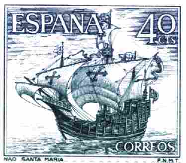
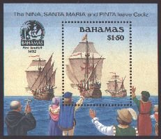
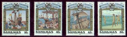
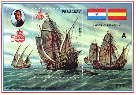
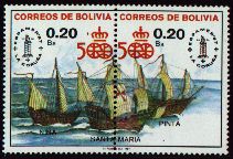
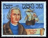
On Postage Stamps SPAIN
BAHAMAS
BOLIVIA
LAOS
|
|
Man and Myth After five centuries, Columbus remains a mysterious and controversial
figure who has been variously described as one of the greatest mariners
in history, a visionary genius, a mystic, a national hero, a failed administrator,
a naive entrepreneur, and a ruthless and greedy imperialist.
Columbus's enterprise to find a westward route to Asia grew out of the practical experience of a long and varied maritime career, as well as out of his considerable reading in geographical and theological literature. He settled for a time in Portugal, where he tried unsuccessfully to enlist support for his project, before moving to Spain. After many difficulties, through a combination of good luck and persuasiveness, he gained the support of the Catholic monarchs, Isabella and Fernando. The widely published report of his voyage of 1492 made Columbus famous throughout Europe and secured for him the title of Admiral of the Ocean Sea and further royal patronage. Columbus, who never abandoned the belief that he had reached Asia, led three more expeditions to the Caribbean. But intrigue and his own administrative failings brought disappointment and political obscurity to his final years. In Search and Defence of Privileges Queen Isabella and King Fernando had agreed to Columbus's lavish demands if he succeeded on his first voyage: he would be knighted, appointed Admiral of the Ocean Sea, made the viceroy of any new lands, and awarded ten percent of any new wealth. By 1502, however, Columbus had every reason to fear for the security of his position. He had been charged with maladministration in the Indies. The Library's vellum copy of the Book of Privileges is one of four that Columbus commissioned to record his agreements with the Spanish crown. It is unique in preserving an unofficial transcription of a Papal Bull of September 26, 1493 in which Pope Alexander VI extended Spain's rights to the New World.
As a reward for his successful voyage of discovery, the Spanish sovereigns granted Columbus the right to bear arms. According to the blazon specified in letters patent dated May 20, 1493, Columbus was to bear in the first and the second quarters the royal charges of Castile and Leon -- the castle and the lion -- but with different tinctures or colors. In the third quarter would be islands in a wavy sea, and in the fourth, the customary arms of his family. The earliest graphic representation of Columbus's arms is found in his Book of Privileges and shows the significant modifications Columbus ordered by his own authority. In addition to the royal charges that were authorized in the top quarters, Columbus adopted the royal colors as well, added a continent among the islands in the third quarter, and for the fourth quarter borrowed five anchors in fess from the blazon of the Admiral of Castille. Columbus's bold usurpation of the royal arms, as well as his choice of additional symbols, help to define his personality and his sense of the significance of his service to the Spanish monarchs.
All three vellum copies have thirty six documents in common, including
the Papal Bull inter caetera of May 4, 1493, defining the line of
demarcation of future Spanish and Portuguese explorations, and specifically
acknowledging Columbus's contributions. The bull is the first document
on vellum in the Library's copy and the thirty sixth document in the Genoa
and the Paris codices. The Library copy does not have the elaborate rubricated
title page, the vividly coloured Columbus coat of arms, or the authenticating
notarial signatures contained in the other copies. The Library's copy,
however, does have a unique transcription of the Papal Bull Dudum siquidem
of September 26, 1493, extending the Spanish donation. The bull is folded
and addressed to the Spanish sovereigns
oil on canvas, 68.5 x 122.1 cm. Image courtesy of: National Library of Australia |
|
The
Agrarian History of Western Europe, A.D. 500 - 1850, Francois
The Admiral and His Lady, M. De Freistas Treen, Speller Press, 1989
Admiral
of the Ocean Sea: A Life of Christopher Columbus, Samuel Eliot
Christopher Columbus, Gianni Granzotto, Univ. of Oxford Press, 1988
Christopher
Columbus, His Life, His Work, His Remains, J.B. Thacher,
Columbus
and The Age of Discovery, Dar-Ner Zvi, William Morrow, New
The
Christopher Columbus Encyclopedia, Silvio A. Bedini, Simon and
Christopher
Columbus, Navigator to the New World, Daniel J. Carrison,
Columbus,
The Great Adventure, Paolo Emilio Taviani, Orion Books, New
Columbus' Ships, Jose Maria Martinez-Hidalgo, Barre, Mass, 1966
The
Food and Wines of Spain, Penelope Casas, Alfred A. Knopf, New
The Food of Italy, Waverly Root, Vintage Books, New York 1971
The
Food of Portugal, Jean Anderson, William Morrow & Co., New York
The
Food of Spain and Portugal, Elisabeth Lambert Ortiz, Atheneneum,
The
Four Voyages of Columbus, Edited by Cecil Jane, Dover Publications,
The Good Food of Italy, Claudia Roden, Alfred A. Knopf, New York, 1991 History of Wine and The Vine, Enjalbert, Paris, 1987 Italian Regional Cooking, Ada Boni, Bonanza Books, New York, 1969
Journals
and Other Documents on the Life and Voyages of Christopher
Land
and Society in Golden Age Castile, David E. Vassberg, Cambridge,
Life
at Sea in the Age of Sail, W.R. Thrower, Phillimore & Co. Ltd,
Sussex,
The
Life of Admiral Christopher Columbus by his son, Ferdinand,
The
Log of Christopher Columbus, Translated by Robert H. Fuson,
Mediterranean Cookery, Claudia Roden, Alfred A. Knopf, New York, 1987 North Atlantic Seafood, Alan Davidson, Macmillan, London, 1979
Why
We Eat What We Eat, Raymond Sokolov, Summit Books, New York,
The
Wines and Vineyards of Spain, Miguel A. Torres, Editorial Blume,
The Wines of Portugal, Jan Read, Faber and Faber, London, 1982, 1987
The
Wines of Spain and Portugal, Jan Read, Faber and Faber, London,
Wine
Regions of the World, David Burroughs and Norman Bezzant,
The
World of Christopher Columbus, William D. Phillips, Jr. and Carla
|

Webpage © 1995-2017
Isle of Standauffish
These Articles © Data
Wales
These Articles are copyright © 1997 by Keith
A. Pickering
The Columbus
Navigation Home page
 The
three ships set sail from Palos on August 3rd 1492. There were altogether
90 men on board, of whom some 40 were on the Santa Maria with Columbus.
Part of the diary kept by Columbus on his first voyage to the New World
tells of several ‘false alarms’ before the ship actually sighted land.
On September 18th, having seen huge flocks or birds, the sailors expected
land to be near, a feeling confirmed by their sighting boobies and other
birds on September 20th.
The
three ships set sail from Palos on August 3rd 1492. There were altogether
90 men on board, of whom some 40 were on the Santa Maria with Columbus.
Part of the diary kept by Columbus on his first voyage to the New World
tells of several ‘false alarms’ before the ship actually sighted land.
On September 18th, having seen huge flocks or birds, the sailors expected
land to be near, a feeling confirmed by their sighting boobies and other
birds on September 20th. 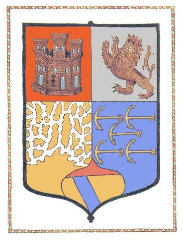
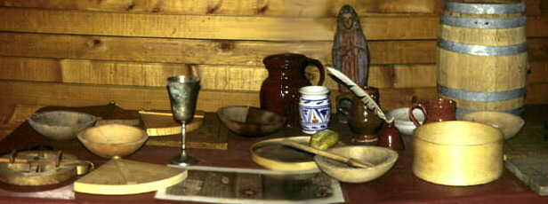
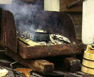 At
the time of Columbus, the only means of cooking was an open firebox called
“Fogon.” It was equipped with a back to screen it from the wind. Sand was
spread on the floor of the box and a wood fire built on it. Of course,
all this was obliterated in stormy weather. Later on, portable ovens were
made available to set up ashore when the opportunity arose.
At
the time of Columbus, the only means of cooking was an open firebox called
“Fogon.” It was equipped with a back to screen it from the wind. Sand was
spread on the floor of the box and a wood fire built on it. Of course,
all this was obliterated in stormy weather. Later on, portable ovens were
made available to set up ashore when the opportunity arose.
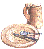 For
drink the crew had wine and water. Both were stored in wooden barrels.
The wine was red and high in alcohol - a preservative feature. It probably
came from the hot, dry, undulating treeless chalky plains of Xeres (Jerez)
near Cadiz, where the vines were first planted by the Phoenicians, tended
by the Greeks after them and then the Romans and much later the Moors.
The wines while rich in character were not fortified at that time. Fortification
came much later. During the days of calm at sea, the sailors would fish
and then cook their catch.
For
drink the crew had wine and water. Both were stored in wooden barrels.
The wine was red and high in alcohol - a preservative feature. It probably
came from the hot, dry, undulating treeless chalky plains of Xeres (Jerez)
near Cadiz, where the vines were first planted by the Phoenicians, tended
by the Greeks after them and then the Romans and much later the Moors.
The wines while rich in character were not fortified at that time. Fortification
came much later. During the days of calm at sea, the sailors would fish
and then cook their catch.
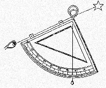 The
most important tool used by Columbus in his celestial attempts was the
quadrant. This was a metal plate in the shape of a quarter circle. From
the centre of the circle hung a weight on a string, that crossed the opposite
edge of the circle (see figure 1). The navigator would sight the North
Star along one edge, and the point that the string crossed the edge would
show the star's altitude, or angle above the horizon. (In the case of the
North Star, this is always pretty close to your latitude). Many examples
of quadrants survive in maritime museums, and often have several scales
along the edge. For example, in addition to the angle, you might also read
the tangent of the angle from the quadrant. The tangent scale is useful
if the quadrant is to be used for architectural purposes.
The
most important tool used by Columbus in his celestial attempts was the
quadrant. This was a metal plate in the shape of a quarter circle. From
the centre of the circle hung a weight on a string, that crossed the opposite
edge of the circle (see figure 1). The navigator would sight the North
Star along one edge, and the point that the string crossed the edge would
show the star's altitude, or angle above the horizon. (In the case of the
North Star, this is always pretty close to your latitude). Many examples
of quadrants survive in maritime museums, and often have several scales
along the edge. For example, in addition to the angle, you might also read
the tangent of the angle from the quadrant. The tangent scale is useful
if the quadrant is to be used for architectural purposes.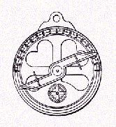 Columbus
also carried an astrolabe on the first voyage, which is somewhat similar
to the quadrant. The astrolabe was a complete circle of metal, and had
a moving arm (or alidade) that the navigator would sight along to find
the star's altitude. Columbus tried to use the astrolabe once, but was
stymied by bad weather, and he never used it again. Both the quadrant and
astrolabe are dependent upon gravity to work, so they can measure only
vertical angles. The quadrant was accurate to about a degree or so, and
the astrolabe was a little less accurate.
Columbus
also carried an astrolabe on the first voyage, which is somewhat similar
to the quadrant. The astrolabe was a complete circle of metal, and had
a moving arm (or alidade) that the navigator would sight along to find
the star's altitude. Columbus tried to use the astrolabe once, but was
stymied by bad weather, and he never used it again. Both the quadrant and
astrolabe are dependent upon gravity to work, so they can measure only
vertical angles. The quadrant was accurate to about a degree or so, and
the astrolabe was a little less accurate. After navigating successfully across the Atlantic using his familiar
dead reckoning methods, Columbus tried to find his latitude using the quadrant
on October 30, 1492. At the time, he was at Puerto de Mares, Cuba, usually
identified with the modern Puerto Gibara, at about 20 degrees North latitude.
But the result he obtained from the quadrant was 42 degrees. He made another
reading from the same place on November 2, and got the same flawed result.
After navigating successfully across the Atlantic using his familiar
dead reckoning methods, Columbus tried to find his latitude using the quadrant
on October 30, 1492. At the time, he was at Puerto de Mares, Cuba, usually
identified with the modern Puerto Gibara, at about 20 degrees North latitude.
But the result he obtained from the quadrant was 42 degrees. He made another
reading from the same place on November 2, and got the same flawed result.  The
quadrant readings Columbus obtained on his first voyage are horrible by
any standard. Some have suggested that Columbus mistook another star for
Polaris, but that seems ridiculous: Columbus used the stars of Ursa Minor
to tell time at night, so he was very familiar with that constellation.
In 1983, James E. Kelley, Jr. provided the solution to the mystery: as
mentioned above, many quadrants in maritime museums have tangent scales.
If Columbus misread the scale, he might have recorded the tangent of his
latitude (without the decimal point) instead of his actual latitude. If
that were the case, Columbus's measurements would only be wrong by a couple
of degrees or so, which is not bad considering the technology.
The
quadrant readings Columbus obtained on his first voyage are horrible by
any standard. Some have suggested that Columbus mistook another star for
Polaris, but that seems ridiculous: Columbus used the stars of Ursa Minor
to tell time at night, so he was very familiar with that constellation.
In 1983, James E. Kelley, Jr. provided the solution to the mystery: as
mentioned above, many quadrants in maritime museums have tangent scales.
If Columbus misread the scale, he might have recorded the tangent of his
latitude (without the decimal point) instead of his actual latitude. If
that were the case, Columbus's measurements would only be wrong by a couple
of degrees or so, which is not bad considering the technology.
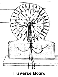 Speed
(and distance) was measured every hour. The officer of the watch would
keep track of the speed and course sailed every hour by using a toleta,
or traverse board. This was a peg-board with holes radiating from the centre
along every point of the compass. The peg was moved from the centre along
the course travelled, for the distance made during that hour. After four
hours, another peg was used to represent the distance made good in leagues
during the whole watch. At the end of the day, the total distance and course
for the day was transferred to the chart.
Speed
(and distance) was measured every hour. The officer of the watch would
keep track of the speed and course sailed every hour by using a toleta,
or traverse board. This was a peg-board with holes radiating from the centre
along every point of the compass. The peg was moved from the centre along
the course travelled, for the distance made during that hour. After four
hours, another peg was used to represent the distance made good in leagues
during the whole watch. At the end of the day, the total distance and course
for the day was transferred to the chart.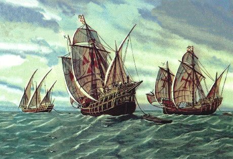
![[Image of Pinta and Santa Maria]](../../../02top/20ship/SpanishGalleons/images/caravel02.jpg)

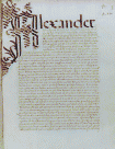 The
Book of Privileges is a collection of agreements between Columbus and the
crowns of Spain prepared in Seville in 1502 before his 4th final voyage.
The compilation of documents includes the 1497 confirmation of the rights
to titles and profits granted to the Admiral by the 1492 contract of Santa
Fe and augmented in 1493 and 1494, as well as routine instructions and
authorizations related to his third voyage. We know that four copies of
his Book of Privileges existed in 1502, three written on vellum and one
on paper.
The
Book of Privileges is a collection of agreements between Columbus and the
crowns of Spain prepared in Seville in 1502 before his 4th final voyage.
The compilation of documents includes the 1497 confirmation of the rights
to titles and profits granted to the Admiral by the 1492 contract of Santa
Fe and augmented in 1493 and 1494, as well as routine instructions and
authorizations related to his third voyage. We know that four copies of
his Book of Privileges existed in 1502, three written on vellum and one
on paper.