|
European Incoherent Scatter Scientific Association |
||||||||||||||||||||||||||||||||||||||||||||||||||||||||||||||||||||||||||||||||||||||||||||||||||||||||||||||||||||||||||||||||||||||||||||
|
+1° 45' 56.63", -157° 12' 2.55" ..
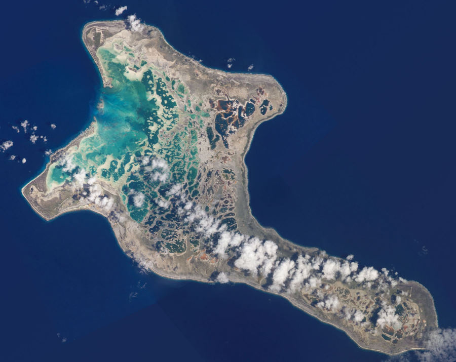
Some confusion over Christmas Island While searching for the EISCAT Station supposed to
be on Christmas Island we found that there are in fact two islands with
that name.  The Antennas are on Kiritimati (Christmas) Island From a list of stations around the world...
...we find Christmas Island given Lat 2.0 Long
-158.0. This puts us into the ocean near the island. It is also strange
to note that there is a ghost outline image of this island halfway between
the above coordinates and the image of the island. So far we have not been
able to spot the antenna facility on the island. However the list below
gives us many new places to look for network components
Cassidy International Airport – Kiritimati (Christmas Island) List of sampled CEDAR ground-based component of TIMED
Developed by Jens Oberheide (jenso@ucar.edu): 19 December 2002 Last update by Jens Oberheide: 19 January 2003 Copyright 2002, NCAR |
||||||||||||||||||||||||||||||||||||||||||||||||||||||||||||||||||||||||||||||||||||||||||||||||||||||||||||||||||||||||||||||||||||||||||||
|
..
Kiritimati or Christmas Island is a Pacific Ocean atoll in the northern Line Islands and part of the Republic of Kiribati. Nuclear tests were conducted on the island by the United Kingdom in the late 1950s. During these tests islanders were not evacuated. Subsequently British servicemen as well as local islanders have claimed to have suffered from exposure to the radiation from these blasts. Kiritimati was discovered by Captain James Cook on
Christmas Eve (December 24), 1777. It was claimed by the United States
under the Guano Islands Act of 1856, though little actual mining of guano
took place. This claim was formally ceded by the Treaty of Tarawa between
US and Kiribati, signed in 1979 and ratified in 1983. Permanent settlement
started by 1882, mainly by workers in coconut plantations and fishermen,
but due to an extreme drought which killed off tens of thousands of Coconut
Palms – about 75% of Kiritimati's population of this plant – the island
was once again abandoned between 1905 and 1912.[1]
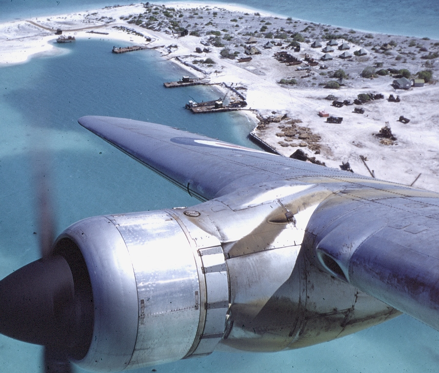
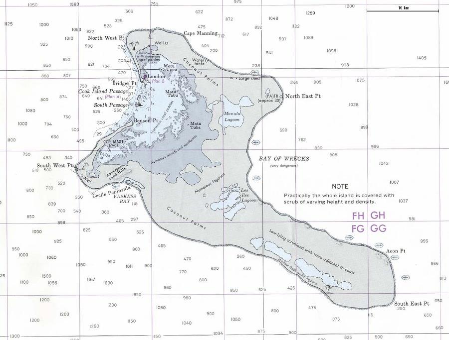
Many of the toponyms in the island go back to Father Emmanuel Rougier, a French priest who leased the island from 1917 to 1939 and planted some 800,000 coconut trees there. He lived in his Paris house (now only small ruins) located at Benson Point, across the Burgle Channel from Londres (today London) at Bridges Point where he established the port. In World War II, Kiritimati was occupied by the Allies, and the first airstrip was constructed then,[1] for servicing the US Army Air Force weather station communications center. The airstrip also provided rest and refueling facilities for planes traveling between Hawaii and the South Pacific. There was also a small civilian radio-meteorological research station.
During the Cold War there was some nuclear testing in the Kiritimati area. The British supposedly conducted their first successful hydrogen bomb test at Malden Island on May 15 1957; Kiritimati was the operation's main base. In fact, this test was a failure, and the first British H-bomb was successfully detonated over the southeastern tip of Kiritimati on November 8, 1957. Subsequent test series in 1958 (Grapple Y and Z) took place above or near Kiritimati itself. The United States conducted 22 successful nuclear detonations as part of Operation Dominic here in 1962. Some toponyms (like Banana and Main Camp) come from the nuclear testing period, during which at times over 4,000 servicemen were present. By 1969, military interest in Kiritimati had ceased and the facilities were abandoned and for the most part dismantled. Some communications, transport and logistics facilities, however, were converted for civilian use and it is due to these installations that Kiritimati came to serve as the administrative center for the Line Islands.[1] The United Kingdom detonated some 5 megatons of nuclear payload near and 1.8 megatons directly above Kiritimati in 1957/58, while the United States between 25 April and 11 July 1962 successfully tested nuclear devices of about 24 megatons payload altogether in the vicinity of the island. During the British Grapple X test of November 8, 1957, which took place directly above the southeastern tip of Kiritimati, yield was stronger than expected and there was some blast damage in the settlements. Islanders were usually not evacuated during the nuclear testing, and data on the environmental and public health impact of these tests remains contested. SOURCE: Wikipedia Kiritimati See Also:
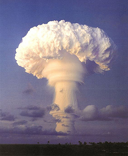 British nuclear tests at Kiritimati - Christmas Island |
||||||||||||||||||||||||||||||||||||||||||||||||||||||||||||||||||||||||||||||||||||||||||||||||||||||||||||||||||||||||||||||||||||||||||||
Connections
|
||||||||||||||||||||||||||||||||||||||||||||||||||||||||||||||||||||||||||||||||||||||||||||||||||||||||||||||||||||||||||||||||||||||||||||
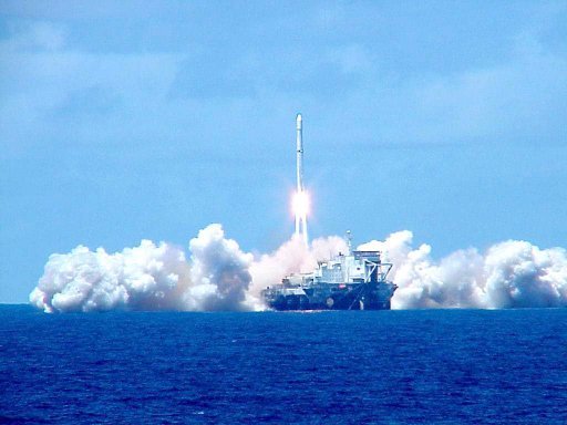 Sea Launch satellite launching off Kiritimati Island |
||||||||||||||||||||||||||||||||||||||||||||||||||||||||||||||||||||||||||||||||||||||||||||||||||||||||||||||||||||||||||||||||||||||||||||
| FAIR USE NOTICE: This page contains copyrighted material the use of which has not been specifically authorized by the copyright owner. Pegasus Research Consortium distributes this material without profit to those who have expressed a prior interest in receiving the included information for research and educational purposes. We believe this constitutes a fair use of any such copyrighted material as provided for in 17 U.S.C § 107. If you wish to use copyrighted material from this site for purposes of your own that go beyond fair use, you must obtain permission from the copyright owner. | ||||||||||||||||||||||||||||||||||||||||||||||||||||||||||||||||||||||||||||||||||||||||||||||||||||||||||||||||||||||||||||||||||||||||||||
|
|
